
USP KN.USP - Earthquake Result Viewer
| ||||||||||||||||||
| ||||||||||||||||||
| ||||||||||||||||||
|
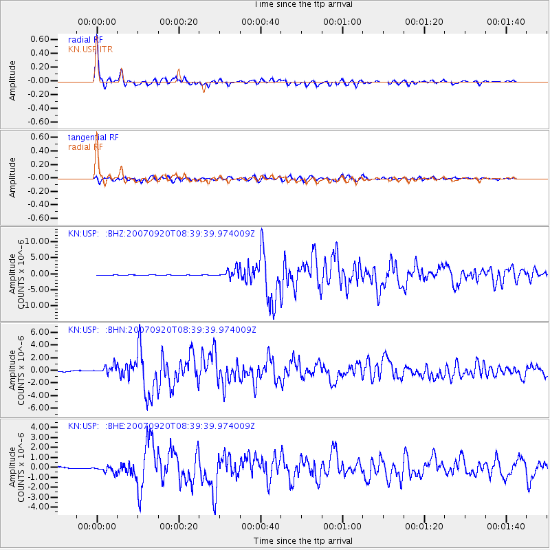
Signal To Noise
| Channel | StoN | STA | LTA |
| KN:USP: :BHN:20070920T08:39:39.974009Z | 5.122999 | 6.471272E-7 | 1.2631803E-7 |
| KN:USP: :BHE:20070920T08:39:39.974009Z | 6.077339 | 3.362337E-7 | 5.532581E-8 |
| KN:USP: :BHZ:20070920T08:39:39.974009Z | 24.815208 | 1.4353951E-6 | 5.7843362E-8 |
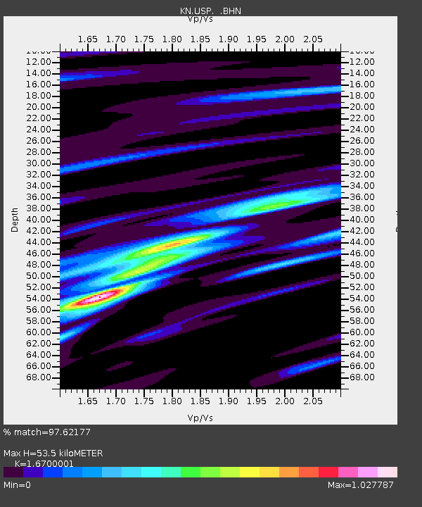
| Arrivals | |
| Ps | 6.0 SECOND |
| PpPs | 21 SECOND |
| PsPs/PpSs | 27 SECOND |

