USP KN.USP - Earthquake Result Viewer
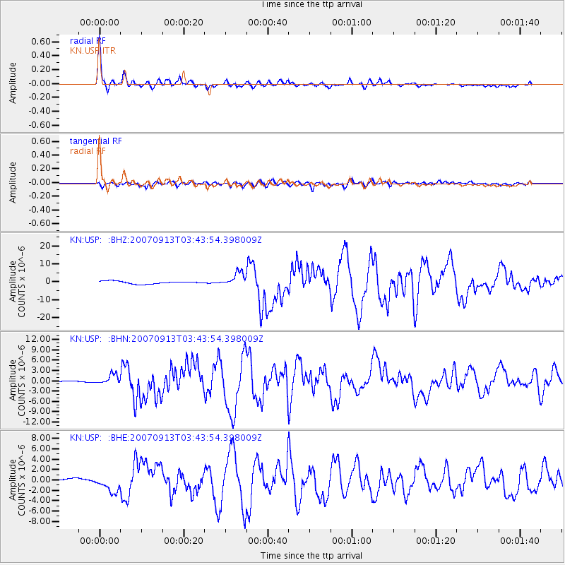
Earthquake location: Southern Sumatra, Indonesia
Earthquake latitude/longitude: -2.1/99.6
Earthquake time(UTC): 2007/09/13 (256) 03:35:28 GMT
Earthquake Depth: 22 km
Earthquake Magnitude: 6.3 MB, 7.2 MS, 7.0 MW, 7.1 ME
Earthquake Catalog/Contributor: WHDF/NEIC
Network: KN Kyrgyz Seismic Telemetry Network
Station: USP KN.USP
Lat/Lon: 43.27 N/74.50 E
Elevation: 740 m
Distance: 50.5 deg
Az: 336.309 deg
Baz: 146.654 deg
Ray Param: 0.067963
Estimated Moho Depth: 54.75 km
Estimated Crust Vp/Vs: 1.64
Assumed Crust Vp: 6.306 km/s
Estimated Crust Vs: 3.839 km/s
Estimated Crust Poisson's Ratio: 0.21
Radial Match: 97.717834 %
Radial Bump: 357
Transverse Match: 90.27398 %
Transverse Bump: 400
SOD ConfigId: 2564
Insert Time: 2010-03-08 22:14:55.498 +0000
GWidth: 2.5
Max Bumps: 400
Tol: 0.001

Signal To Noise

ChannelStoNSTALTA
KN:USP: :BHN:20070913T03:43:54.398009Z2.62546231.4074325E-65.3607033E-7
KN:USP: :BHE:20070913T03:43:54.398009Z4.0869771.7385402E-64.2538537E-7
KN:USP: :BHZ:20070913T03:43:54.398009Z5.4950923.9957345E-67.2714613E-7
Arrivals
Ps5.9 SECOND
PpPs22 SECOND
PsPs/PpSs28 SECOND