
USP KN.USP - Earthquake Result Viewer
| ||||||||||||||||||
| ||||||||||||||||||
| ||||||||||||||||||
|
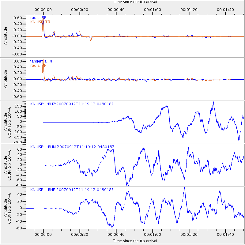
Signal To Noise
| Channel | StoN | STA | LTA |
| KN:USP: :BHN:20070912T11:19:12.048018Z | 4.119415 | 7.4361805E-7 | 1.8051546E-7 |
| KN:USP: :BHE:20070912T11:19:12.048018Z | 4.12972 | 6.653047E-7 | 1.6110164E-7 |
| KN:USP: :BHZ:20070912T11:19:12.048018Z | 4.33709 | 1.5019137E-6 | 3.4629528E-7 |
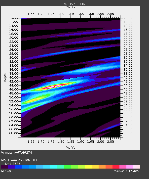
| Arrivals | |
| Ps | 5.7 SECOND |
| PpPs | 18 SECOND |
| PsPs/PpSs | 24 SECOND |

