
USP KN.USP - Earthquake Result Viewer
| ||||||||||||||||||
| ||||||||||||||||||
| ||||||||||||||||||
|
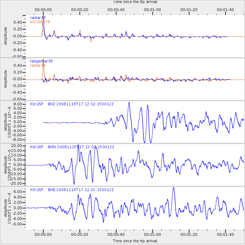
Signal To Noise
| Channel | StoN | STA | LTA |
| KN:USP: :BHN:20081116T17:12:02.150012Z | 7.6834235 | 6.8186256E-7 | 8.874462E-8 |
| KN:USP: :BHE:20081116T17:12:02.150012Z | 1.1307895 | 6.242231E-7 | 5.520241E-7 |
| KN:USP: :BHZ:20081116T17:12:02.150012Z | 4.1300187 | 3.0826368E-7 | 7.463978E-8 |
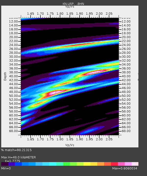
| Arrivals | |
| Ps | 6.2 SECOND |
| PpPs | 20 SECOND |
| PsPs/PpSs | 26 SECOND |

