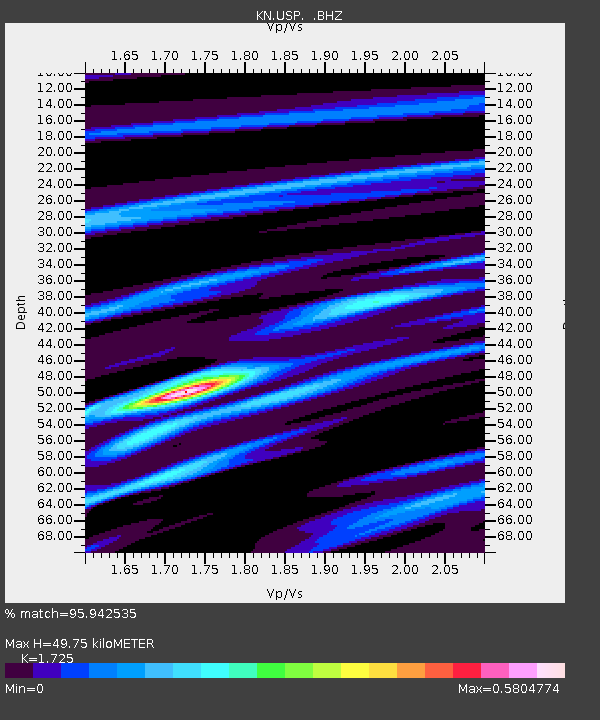
USP KN.USP - Earthquake Result Viewer
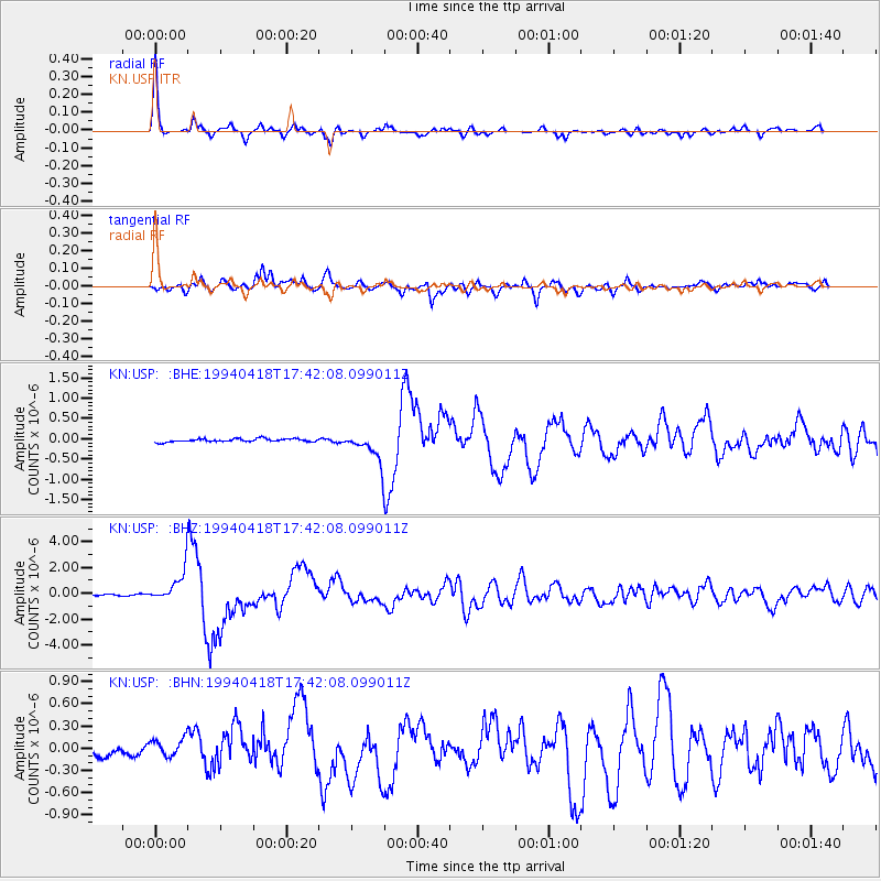
Earthquake location: Solomon Islands
Earthquake latitude/longitude: -6.5/154.9
Earthquake time(UTC): 1994/04/18 (108) 17:29:56 GMT
Earthquake Depth: 43 km
Earthquake Magnitude: 6.6 MB, 6.7 MS, 6.8 UNKNOWN, 6.7 MW
Earthquake Catalog/Contributor: WHDF/NEIC
Network: KN Kyrgyz Seismic Telemetry Network
Station: USP KN.USP
Lat/Lon: 43.27 N/74.50 E
Elevation: 740 m
Distance: 87.5 deg
Az: 313.865 deg
Baz: 101.252 deg
Ray Param: 0.043242365
Estimated Moho Depth: 49.75 km
Estimated Crust Vp/Vs: 1.73
Assumed Crust Vp: 6.306 km/s
Estimated Crust Vs: 3.656 km/s
Estimated Crust Poisson's Ratio: 0.25
Radial Match: 95.942535 %
Radial Bump: 315
Transverse Match: 89.80689 %
Transverse Bump: 400
SOD ConfigId: 4480
Insert Time: 2010-03-08 22:15:59.353 +0000
GWidth: 2.5
Max Bumps: 400
Tol: 0.001

Signal To Noise

ChannelStoNSTALTA
KN:USP: :BHZ:19940418T17:42:08.099011Z29.3881031.2831222E-64.3661277E-8
KN:USP: :BHN:19940418T17:42:08.099011Z1.81068671.4024238E-77.745259E-8
KN:USP: :BHE:19940418T17:42:08.099011Z8.7810373.557965E-74.051873E-8
Arrivals
Ps5.8 SECOND
PpPs21 SECOND
PsPs/PpSs27 SECOND