You are here: Home > Network List > US - United States National Seismic Network Stations List
> Station HAWA Hanford, Washington, USA > Earthquake Result Viewer
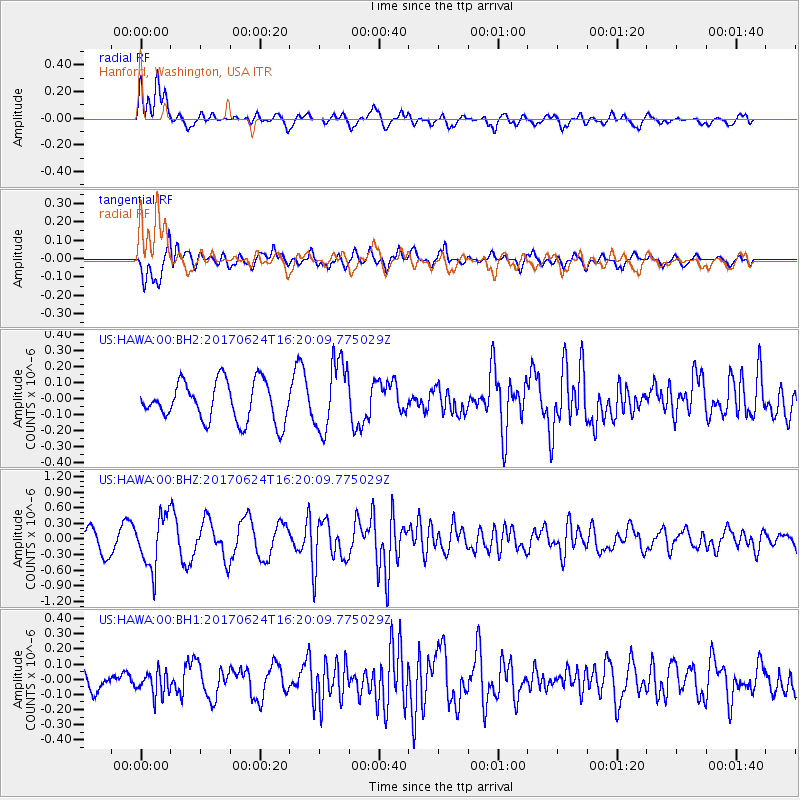
HAWA Hanford, Washington, USA - Earthquake Result Viewer
*The percent match for this event was below the threshold and hence no stack was calculated.
| Earthquake location: |
Southern Peru |
| Earthquake latitude/longitude: |
-15.5/-73.5 |
| Earthquake time(UTC): |
2017/06/24 (175) 16:09:11 GMT |
| Earthquake Depth: |
69 km |
| Earthquake Magnitude: |
5.7 Mww |
| Earthquake Catalog/Contributor: |
NEIC PDE/us |
|
| Network: |
US United States National Seismic Network |
| Station: |
HAWA Hanford, Washington, USA |
| Lat/Lon: |
46.39 N/119.53 W |
| Elevation: |
364 m |
|
| Distance: |
74.2 deg |
| Az: |
328.8 deg |
| Baz: |
133.807 deg |
| Ray Param: |
$rayparam |
*The percent match for this event was below the threshold and hence was not used in the summary stack. |
|
| Radial Match: |
68.943634 % |
| Radial Bump: |
400 |
| Transverse Match: |
71.98194 % |
| Transverse Bump: |
400 |
| SOD ConfigId: |
2140511 |
| Insert Time: |
2017-07-08 08:05:03.446 +0000 |
| GWidth: |
2.5 |
| Max Bumps: |
400 |
| Tol: |
0.001 |
|
Signal To Noise
| Channel | StoN | STA | LTA |
| US:HAWA:00:BHZ:20170624T16:20:09.775029Z | 2.5723264 | 4.9997055E-7 | 1.9436514E-7 |
| US:HAWA:00:BH1:20170624T16:20:09.775029Z | 0.9470062 | 8.055365E-8 | 8.5061366E-8 |
| US:HAWA:00:BH2:20170624T16:20:09.775029Z | 1.778846 | 2.1899966E-7 | 1.2311334E-7 |
| Arrivals |
| Ps | |
| PpPs | |
| PsPs/PpSs | |


