
USP KN.USP - Earthquake Result Viewer
| ||||||||||||||||||
| ||||||||||||||||||
| ||||||||||||||||||
|
Signal To Noise
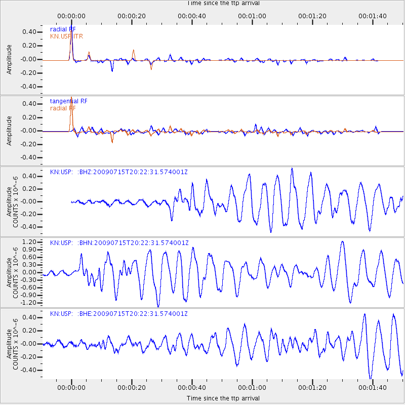
| Channel | StoN | STA | LTA |
| KN:USP: :BHN:20090715T20:22:31.574001Z | 4.7921524 | 2.642157E-7 | 5.513508E-8 |
| KN:USP: :BHE:20090715T20:22:31.574001Z | 0.8210421 | 3.2402575E-8 | 3.946518E-8 |
| KN:USP: :BHZ:20090715T20:22:31.574001Z | 4.3714094 | 1.057427E-7 | 2.4189614E-8 |
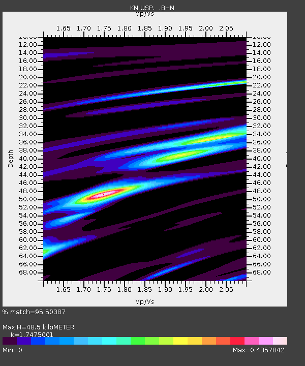
| Arrivals | |
| Ps | 5.9 SECOND |
| PpPs | 21 SECOND |
| PsPs/PpSs | 26 SECOND |

