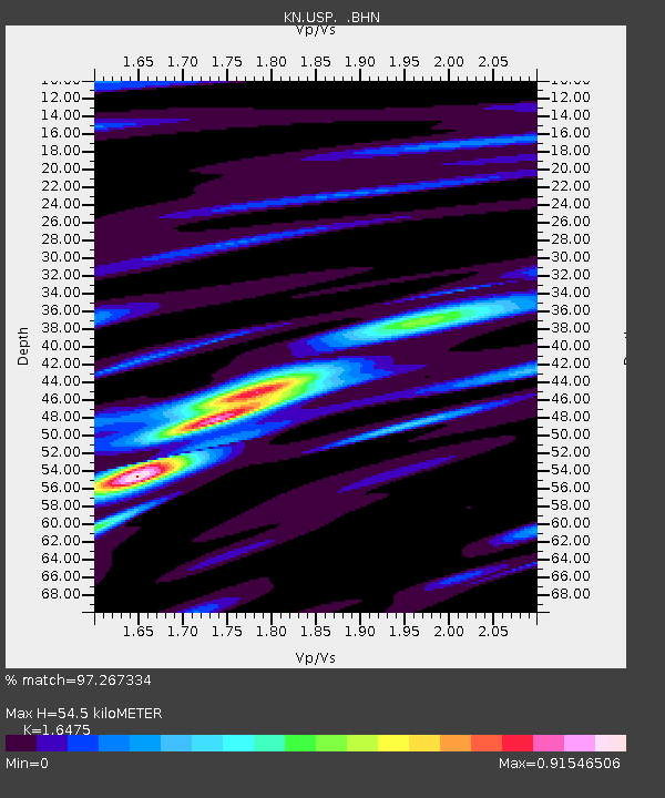
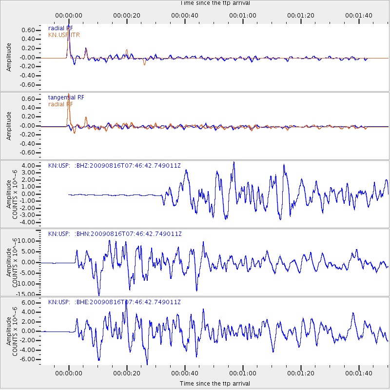
USP KN.USP - Earthquake Result Viewer

Earthquake location: Southern Sumatra, Indonesia
Earthquake latitude/longitude: -1.5/99.5
Earthquake time(UTC): 2009/08/16 (228) 07:38:21 GMT
Earthquake Depth: 20 km
Earthquake Magnitude: 6.5 MB, 6.7 MS, 6.7 MW, 6.5 MW
Earthquake Catalog/Contributor: WHDF/NEIC
Network: KN Kyrgyz Seismic Telemetry Network
Station: USP KN.USP
Lat/Lon: 43.27 N/74.50 E
Elevation: 740 m
Distance: 49.9 deg
Az: 336.201 deg
Baz: 146.478 deg
Ray Param: 0.06839256
Estimated Moho Depth: 54.5 km
Estimated Crust Vp/Vs: 1.65
Assumed Crust Vp: 6.306 km/s
Estimated Crust Vs: 3.828 km/s
Estimated Crust Poisson's Ratio: 0.21
Radial Match: 97.267334 %
Radial Bump: 320
Transverse Match: 88.43897 %
Transverse Bump: 400
SOD ConfigId: 2622
Insert Time: 2010-03-08 22:16:41.891 +0000
GWidth: 2.5
Max Bumps: 400
Tol: 0.001

Signal To Noise

ChannelStoNSTALTA
KN:USP: :BHN:20090816T07:46:42.749011Z34.9049721.7899365E-65.1280274E-8
KN:USP: :BHE:20090816T07:46:42.749011Z29.2069518.9310174E-73.05784E-8
KN:USP: :BHZ:20090816T07:46:42.749011Z12.1112994.972008E-74.105264E-8
Arrivals
Ps5.9 SECOND
PpPs22 SECOND
PsPs/PpSs27 SECOND