You are here: Home > Network List > US - United States National Seismic Network Stations List
> Station WMOK Wichita Mountains, Oklahoma, USA > Earthquake Result Viewer
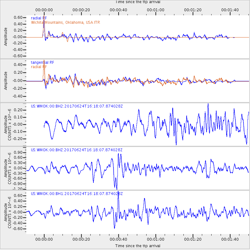
WMOK Wichita Mountains, Oklahoma, USA - Earthquake Result Viewer
*The percent match for this event was below the threshold and hence no stack was calculated.
| Earthquake location: |
Southern Peru |
| Earthquake latitude/longitude: |
-15.5/-73.5 |
| Earthquake time(UTC): |
2017/06/24 (175) 16:09:11 GMT |
| Earthquake Depth: |
69 km |
| Earthquake Magnitude: |
5.7 Mww |
| Earthquake Catalog/Contributor: |
NEIC PDE/us |
|
| Network: |
US United States National Seismic Network |
| Station: |
WMOK Wichita Mountains, Oklahoma, USA |
| Lat/Lon: |
34.74 N/98.78 W |
| Elevation: |
486 m |
|
| Distance: |
55.4 deg |
| Az: |
334.668 deg |
| Baz: |
149.937 deg |
| Ray Param: |
$rayparam |
*The percent match for this event was below the threshold and hence was not used in the summary stack. |
|
| Radial Match: |
76.534294 % |
| Radial Bump: |
400 |
| Transverse Match: |
67.05282 % |
| Transverse Bump: |
400 |
| SOD ConfigId: |
2140511 |
| Insert Time: |
2017-07-08 08:05:45.563 +0000 |
| GWidth: |
2.5 |
| Max Bumps: |
400 |
| Tol: |
0.001 |
|
Signal To Noise
| Channel | StoN | STA | LTA |
| US:WMOK:00:BHZ:20170624T16:18:07.874028Z | 2.6295784 | 1.8588757E-7 | 7.069102E-8 |
| US:WMOK:00:BH1:20170624T16:18:07.874028Z | 2.5052397 | 1.13361E-7 | 4.524956E-8 |
| US:WMOK:00:BH2:20170624T16:18:07.874028Z | 0.8066098 | 5.711024E-8 | 7.0802805E-8 |
| Arrivals |
| Ps | |
| PpPs | |
| PsPs/PpSs | |


