USP KN.USP - Earthquake Result Viewer
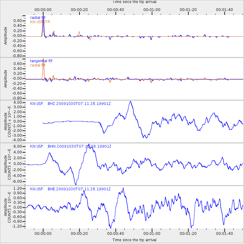
Earthquake location: Ryukyu Islands, Japan
Earthquake latitude/longitude: 29.2/129.8
Earthquake time(UTC): 2009/10/30 (303) 07:03:39 GMT
Earthquake Depth: 34 km
Earthquake Magnitude: 6.3 MB, 6.8 MS, 6.8 MW, 6.8 MW
Earthquake Catalog/Contributor: WHDF/NEIC
Network: KN Kyrgyz Seismic Telemetry Network
Station: USP KN.USP
Lat/Lon: 43.27 N/74.50 E
Elevation: 740 m
Distance: 45.9 deg
Az: 303.338 deg
Baz: 88.826 deg
Ray Param: 0.070883095
Estimated Moho Depth: 50.75 km
Estimated Crust Vp/Vs: 1.66
Assumed Crust Vp: 6.306 km/s
Estimated Crust Vs: 3.799 km/s
Estimated Crust Poisson's Ratio: 0.22
Radial Match: 97.03597 %
Radial Bump: 163
Transverse Match: 86.06184 %
Transverse Bump: 400
SOD ConfigId: 2622
Insert Time: 2010-03-08 22:17:11.878 +0000
GWidth: 2.5
Max Bumps: 400
Tol: 0.001

Signal To Noise

ChannelStoNSTALTA
KN:USP: :BHN:20091030T07:11:28.19901Z29.9496362.2366448E-67.4680194E-8
KN:USP: :BHE:20091030T07:11:28.19901Z0.65519669.160617E-81.3981477E-7
KN:USP: :BHZ:20091030T07:11:28.19901Z8.0352471.3084008E-61.6283268E-7
Arrivals
Ps5.7 SECOND
PpPs20 SECOND
PsPs/PpSs26 SECOND