USP KN.USP - Earthquake Result Viewer
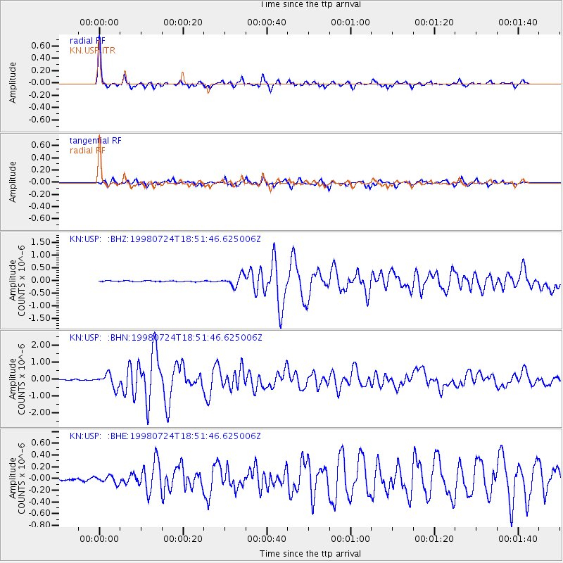
Earthquake location: Taiwan Region
Earthquake latitude/longitude: 21.3/122.0
Earthquake time(UTC): 1998/07/24 (205) 18:44:04 GMT
Earthquake Depth: 33 km
Earthquake Magnitude: 5.6 MB, 5.9 MS, 6.2 UNKNOWN, 6.1 MW
Earthquake Catalog/Contributor: WHDF/NEIC
Network: KN Kyrgyz Seismic Telemetry Network
Station: USP KN.USP
Lat/Lon: 43.27 N/74.50 E
Elevation: 740 m
Distance: 45.1 deg
Az: 310.449 deg
Baz: 103.643 deg
Ray Param: 0.071455695
Estimated Moho Depth: 47.25 km
Estimated Crust Vp/Vs: 1.76
Assumed Crust Vp: 6.306 km/s
Estimated Crust Vs: 3.583 km/s
Estimated Crust Poisson's Ratio: 0.26
Radial Match: 95.50304 %
Radial Bump: 311
Transverse Match: 87.87638 %
Transverse Bump: 400
SOD ConfigId: 4480
Insert Time: 2010-03-08 22:17:37.504 +0000
GWidth: 2.5
Max Bumps: 400
Tol: 0.001

Signal To Noise

ChannelStoNSTALTA
KN:USP: :BHN:19980724T18:51:46.625006Z7.6248844.071941E-75.340332E-8
KN:USP: :BHE:19980724T18:51:46.625006Z2.88943276.3310594E-82.1911081E-8
KN:USP: :BHZ:19980724T18:51:46.625006Z11.5625162.1772065E-71.882987E-8
Arrivals
Ps6.1 SECOND
PpPs19 SECOND
PsPs/PpSs25 SECOND