
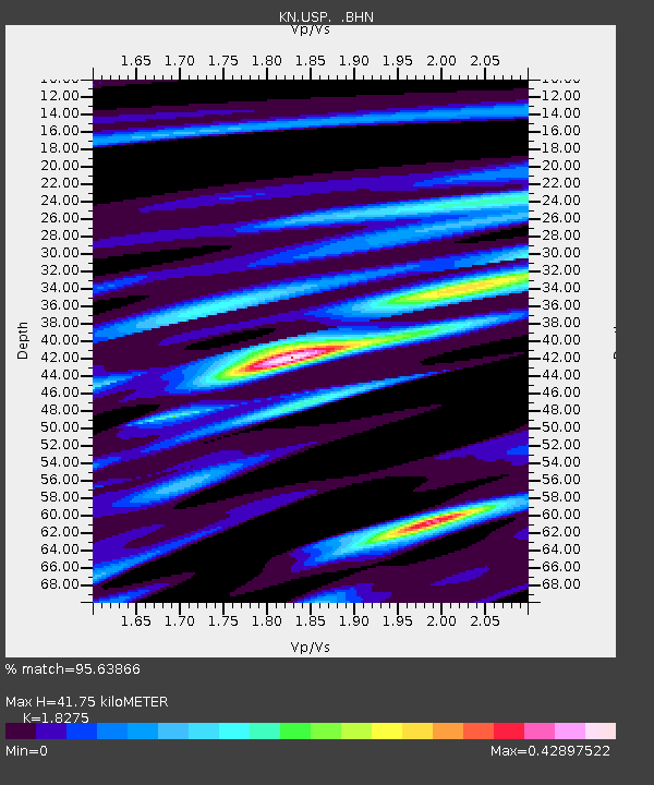
USP KN.USP - Earthquake Result Viewer
| ||||||||||||||||||
| ||||||||||||||||||
| ||||||||||||||||||
|
Signal To Noise
| Channel | StoN | STA | LTA |
| KN:USP: :BHN:19980820T15:10:02.975Z | 31.336565 | 1.7494474E-6 | 5.582767E-8 |
| KN:USP: :BHE:19980820T15:10:02.975Z | 6.980454 | 6.4429054E-7 | 9.229923E-8 |
| KN:USP: :BHZ:19980820T15:10:02.975Z | 8.896739 | 5.944686E-7 | 6.681871E-8 |
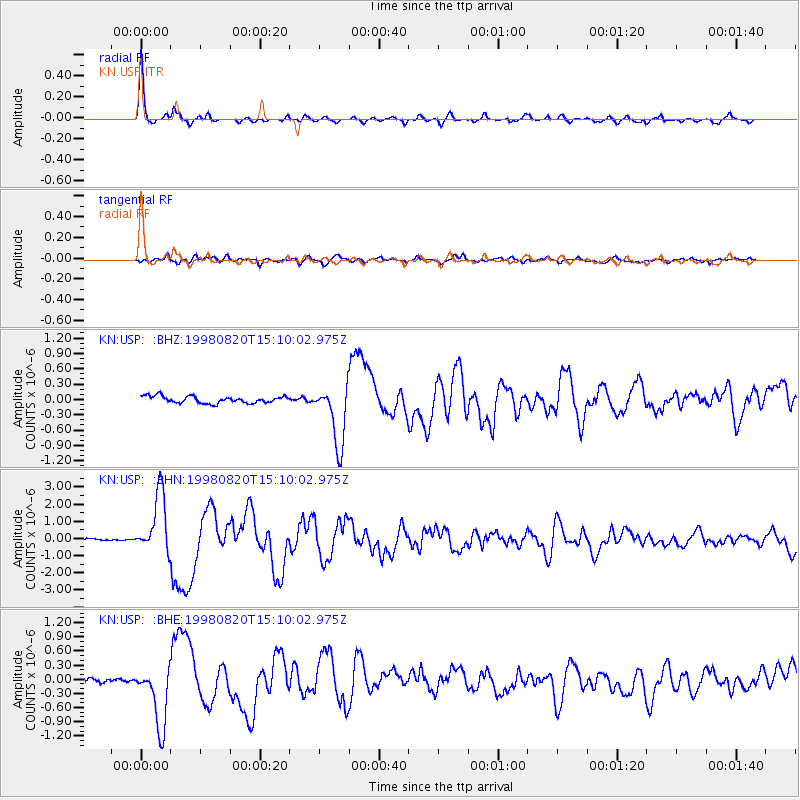
| Arrivals | |
| Ps | 5.7 SECOND |
| PpPs | 18 SECOND |
| PsPs/PpSs | 24 SECOND |

