USP KN.USP - Earthquake Result Viewer
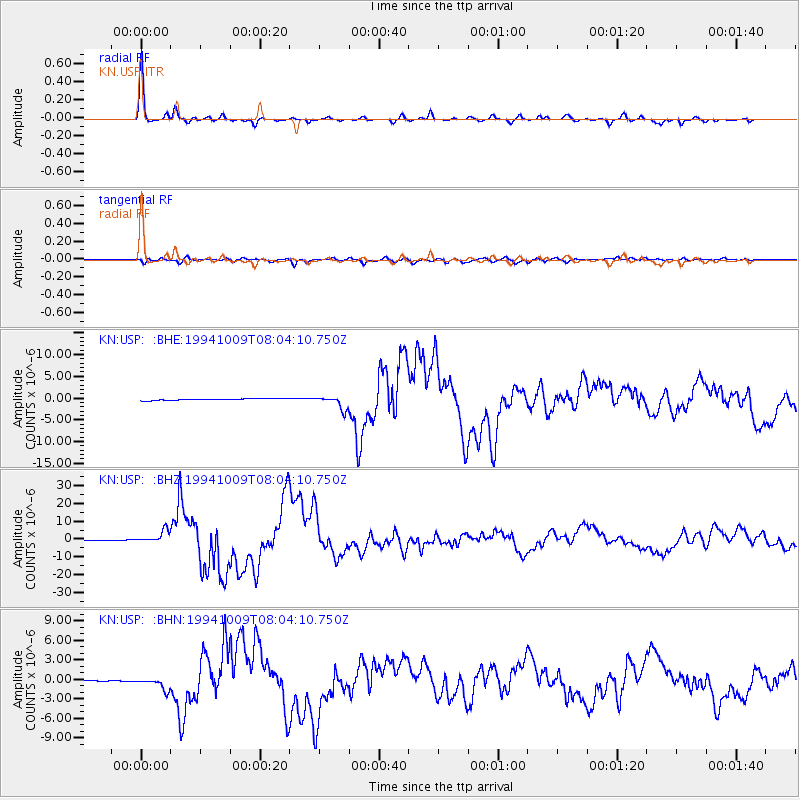
Earthquake location: Kuril Islands
Earthquake latitude/longitude: 43.9/147.9
Earthquake time(UTC): 1994/10/09 (282) 07:55:38 GMT
Earthquake Depth: 23 km
Earthquake Magnitude: 6.5 MB, 7.0 MS, 6.7 UNKNOWN, 7.3 MW
Earthquake Catalog/Contributor: WHDF/NEIC
Network: KN Kyrgyz Seismic Telemetry Network
Station: USP KN.USP
Lat/Lon: 43.27 N/74.50 E
Elevation: 740 m
Distance: 51.5 deg
Az: 296.534 deg
Baz: 62.299 deg
Ray Param: 0.067350425
Estimated Moho Depth: 29.5 km
Estimated Crust Vp/Vs: 2.10
Assumed Crust Vp: 6.306 km/s
Estimated Crust Vs: 3.006 km/s
Estimated Crust Poisson's Ratio: 0.35
Radial Match: 98.61366 %
Radial Bump: 257
Transverse Match: 92.28918 %
Transverse Bump: 400
SOD ConfigId: 4480
Insert Time: 2010-03-08 22:18:01.486 +0000
GWidth: 2.5
Max Bumps: 400
Tol: 0.001

Signal To Noise

ChannelStoNSTALTA
KN:USP: :BHZ:19941009T08:04:10.750Z42.044153.4665359E-68.2449894E-8
KN:USP: :BHN:19941009T08:04:10.750Z12.0079969.989564E-78.3190926E-8
KN:USP: :BHE:19941009T08:04:10.750Z8.4486311.525866E-61.806051E-7
Arrivals
Ps5.4 SECOND
PpPs14 SECOND
PsPs/PpSs19 SECOND