
USP KN.USP - Earthquake Result Viewer
| ||||||||||||||||||
| ||||||||||||||||||
| ||||||||||||||||||
|
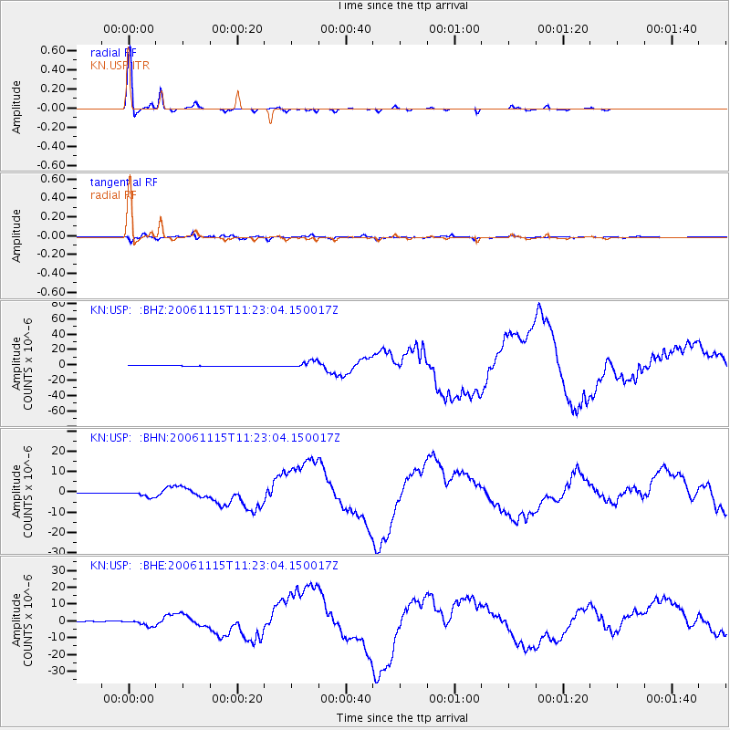
Signal To Noise
| Channel | StoN | STA | LTA |
| KN:USP: :BHN:20061115T11:23:04.150017Z | 7.46896 | 1.336168E-6 | 1.7889613E-7 |
| KN:USP: :BHE:20061115T11:23:04.150017Z | 7.683828 | 1.7486622E-6 | 2.2757696E-7 |
| KN:USP: :BHZ:20061115T11:23:04.150017Z | 17.529343 | 4.502646E-6 | 2.5686336E-7 |
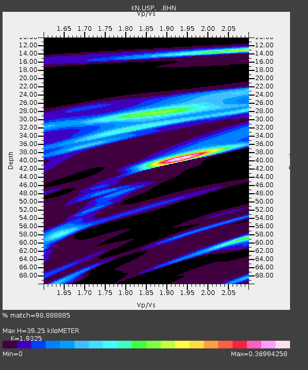
| Arrivals | |
| Ps | 6.1 SECOND |
| PpPs | 17 SECOND |
| PsPs/PpSs | 23 SECOND |

