
USP KN.USP - Earthquake Result Viewer
| ||||||||||||||||||
| ||||||||||||||||||
| ||||||||||||||||||
|
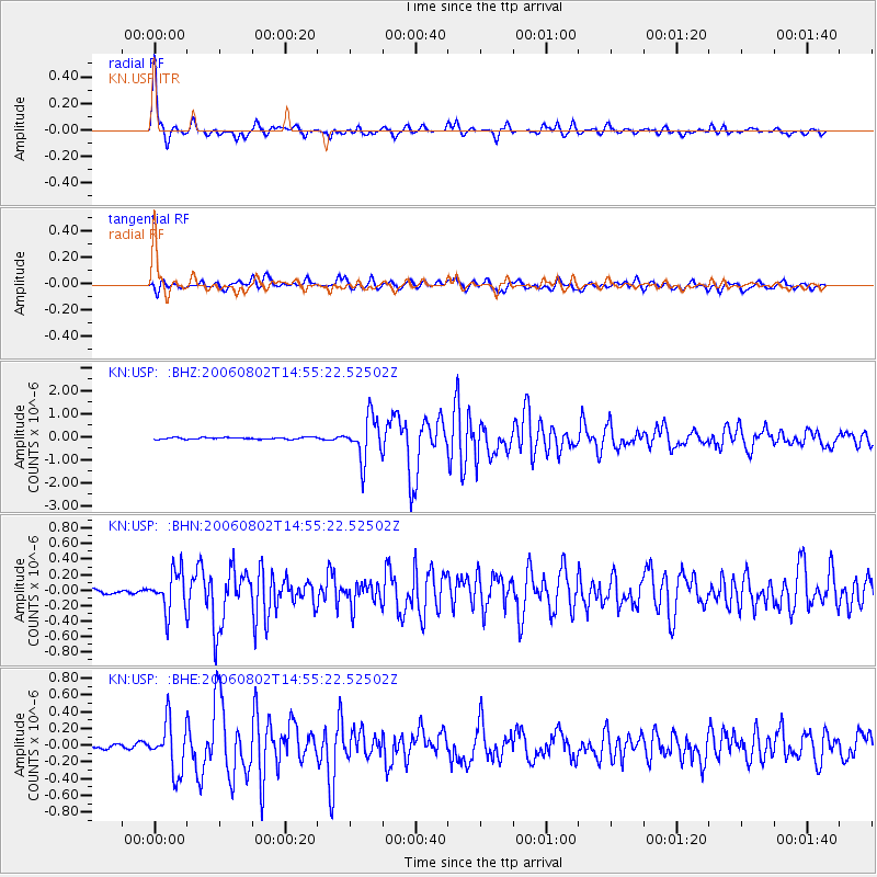
Signal To Noise
| Channel | StoN | STA | LTA |
| KN:USP: :BHN:20060802T14:55:22.52502Z | 6.8313823 | 2.5289867E-7 | 3.702013E-8 |
| KN:USP: :BHE:20060802T14:55:22.52502Z | 14.086077 | 2.9501027E-7 | 2.0943395E-8 |
| KN:USP: :BHZ:20060802T14:55:22.52502Z | 24.414154 | 9.1152197E-7 | 3.7335802E-8 |
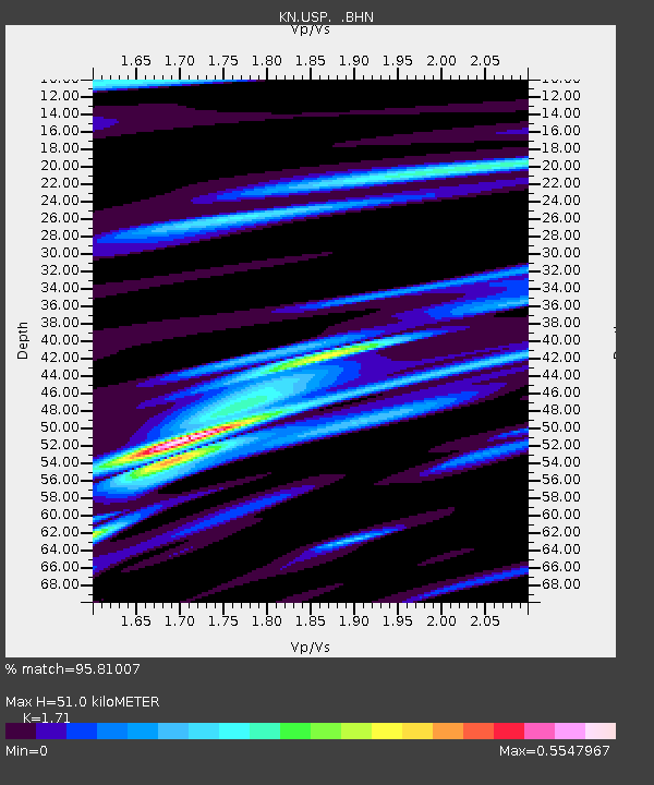
| Arrivals | |
| Ps | 6.0 SECOND |
| PpPs | 21 SECOND |
| PsPs/PpSs | 27 SECOND |

