
USP KN.USP - Earthquake Result Viewer
| ||||||||||||||||||
| ||||||||||||||||||
| ||||||||||||||||||
|
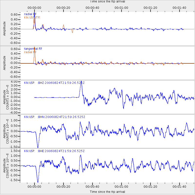
Signal To Noise
| Channel | StoN | STA | LTA |
| KN:USP: :BHN:20060824T21:59:26.525Z | 24.06482 | 7.024107E-7 | 2.9188282E-8 |
| KN:USP: :BHE:20060824T21:59:26.525Z | 35.617466 | 7.4721567E-7 | 2.0978911E-8 |
| KN:USP: :BHZ:20060824T21:59:26.525Z | 72.655754 | 1.8738336E-6 | 2.5790575E-8 |
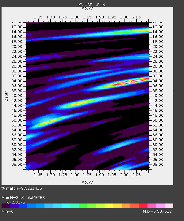
| Arrivals | |
| Ps | 5.8 SECOND |
| PpPs | 16 SECOND |
| PsPs/PpSs | 21 SECOND |

