You are here: Home > Network List > US - United States National Seismic Network Stations List
> Station DGMT Dagmar, Montana, USA > Earthquake Result Viewer
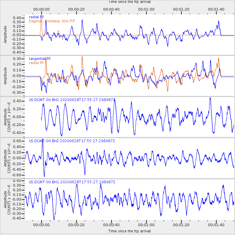
DGMT Dagmar, Montana, USA - Earthquake Result Viewer
*The percent match for this event was below the threshold and hence no stack was calculated.
| Earthquake location: |
Dodecanese Islands, Greece |
| Earthquake latitude/longitude: |
36.7/28.3 |
| Earthquake time(UTC): |
2020/06/28 (180) 17:43:28 GMT |
| Earthquake Depth: |
62 km |
| Earthquake Magnitude: |
5.5 Mww |
| Earthquake Catalog/Contributor: |
NEIC PDE/us |
|
| Network: |
US United States National Seismic Network |
| Station: |
DGMT Dagmar, Montana, USA |
| Lat/Lon: |
48.47 N/104.20 W |
| Elevation: |
0.0 m |
|
| Distance: |
85.2 deg |
| Az: |
330.475 deg |
| Baz: |
36.505 deg |
| Ray Param: |
$rayparam |
*The percent match for this event was below the threshold and hence was not used in the summary stack. |
|
| Radial Match: |
56.876225 % |
| Radial Bump: |
400 |
| Transverse Match: |
51.75703 % |
| Transverse Bump: |
400 |
| SOD ConfigId: |
21709731 |
| Insert Time: |
2020-07-12 18:04:18.043 +0000 |
| GWidth: |
2.5 |
| Max Bumps: |
400 |
| Tol: |
0.001 |
|
Signal To Noise
| Channel | StoN | STA | LTA |
| US:DGMT:00:BHZ:20200628T17:55:27.298987Z | 1.9484277 | 2.996905E-7 | 1.5381146E-7 |
| US:DGMT:00:BH1:20200628T17:55:27.298987Z | 1.4906256 | 1.7454845E-7 | 1.1709744E-7 |
| US:DGMT:00:BH2:20200628T17:55:27.298987Z | 0.5174499 | 1.04656216E-7 | 2.022538E-7 |
| Arrivals |
| Ps | |
| PpPs | |
| PsPs/PpSs | |


