You are here: Home > Network List > US - United States National Seismic Network Stations List
> Station EGMT Eagleton, Montana, USA > Earthquake Result Viewer
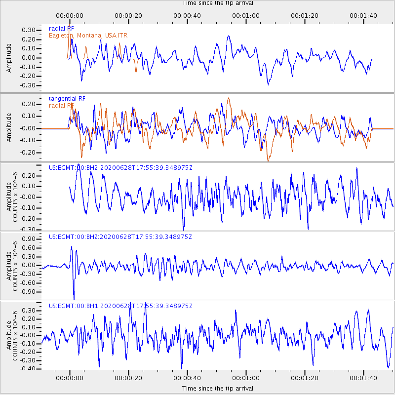
EGMT Eagleton, Montana, USA - Earthquake Result Viewer
*The percent match for this event was below the threshold and hence no stack was calculated.
| Earthquake location: |
Dodecanese Islands, Greece |
| Earthquake latitude/longitude: |
36.7/28.3 |
| Earthquake time(UTC): |
2020/06/28 (180) 17:43:28 GMT |
| Earthquake Depth: |
62 km |
| Earthquake Magnitude: |
5.5 Mww |
| Earthquake Catalog/Contributor: |
NEIC PDE/us |
|
| Network: |
US United States National Seismic Network |
| Station: |
EGMT Eagleton, Montana, USA |
| Lat/Lon: |
48.02 N/109.75 W |
| Elevation: |
1055 m |
|
| Distance: |
87.7 deg |
| Az: |
333.288 deg |
| Baz: |
32.544 deg |
| Ray Param: |
$rayparam |
*The percent match for this event was below the threshold and hence was not used in the summary stack. |
|
| Radial Match: |
50.411167 % |
| Radial Bump: |
400 |
| Transverse Match: |
55.316586 % |
| Transverse Bump: |
400 |
| SOD ConfigId: |
21709731 |
| Insert Time: |
2020-07-12 18:04:21.371 +0000 |
| GWidth: |
2.5 |
| Max Bumps: |
400 |
| Tol: |
0.001 |
|
Signal To Noise
| Channel | StoN | STA | LTA |
| US:EGMT:00:BHZ:20200628T17:55:39.348975Z | 6.925522 | 4.0236986E-7 | 5.8099573E-8 |
| US:EGMT:00:BH1:20200628T17:55:39.348975Z | 0.742125 | 8.2605276E-8 | 1.1130912E-7 |
| US:EGMT:00:BH2:20200628T17:55:39.348975Z | 0.9085974 | 9.8998036E-8 | 1.0895699E-7 |
| Arrivals |
| Ps | |
| PpPs | |
| PsPs/PpSs | |


