
USP KN.USP - Earthquake Result Viewer
| ||||||||||||||||||
| ||||||||||||||||||
| ||||||||||||||||||
|
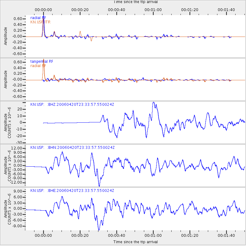
Signal To Noise
| Channel | StoN | STA | LTA |
| KN:USP: :BHN:20060420T23:33:57.550024Z | 22.695112 | 2.166757E-6 | 9.54724E-8 |
| KN:USP: :BHE:20060420T23:33:57.550024Z | 10.391607 | 1.6263451E-6 | 1.5650564E-7 |
| KN:USP: :BHZ:20060420T23:33:57.550024Z | 17.7402 | 4.9338314E-6 | 2.781159E-7 |
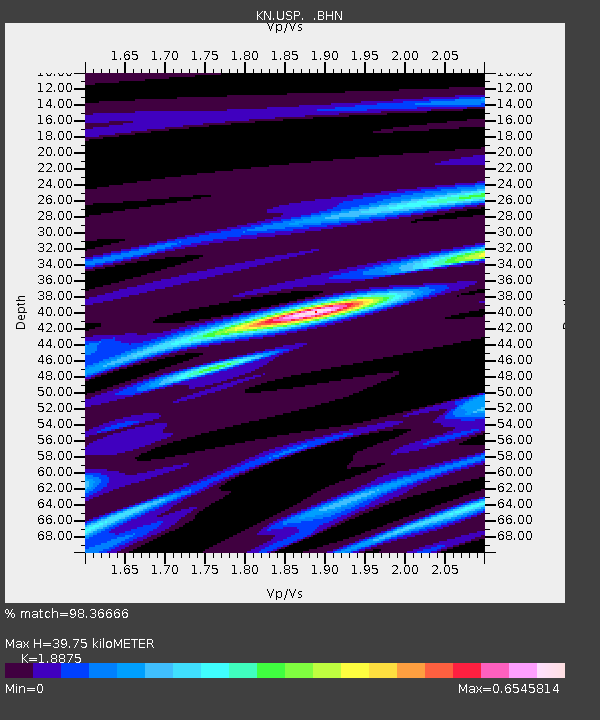
| Arrivals | |
| Ps | 5.9 SECOND |
| PpPs | 17 SECOND |
| PsPs/PpSs | 23 SECOND |

