USP KN.USP - Earthquake Result Viewer
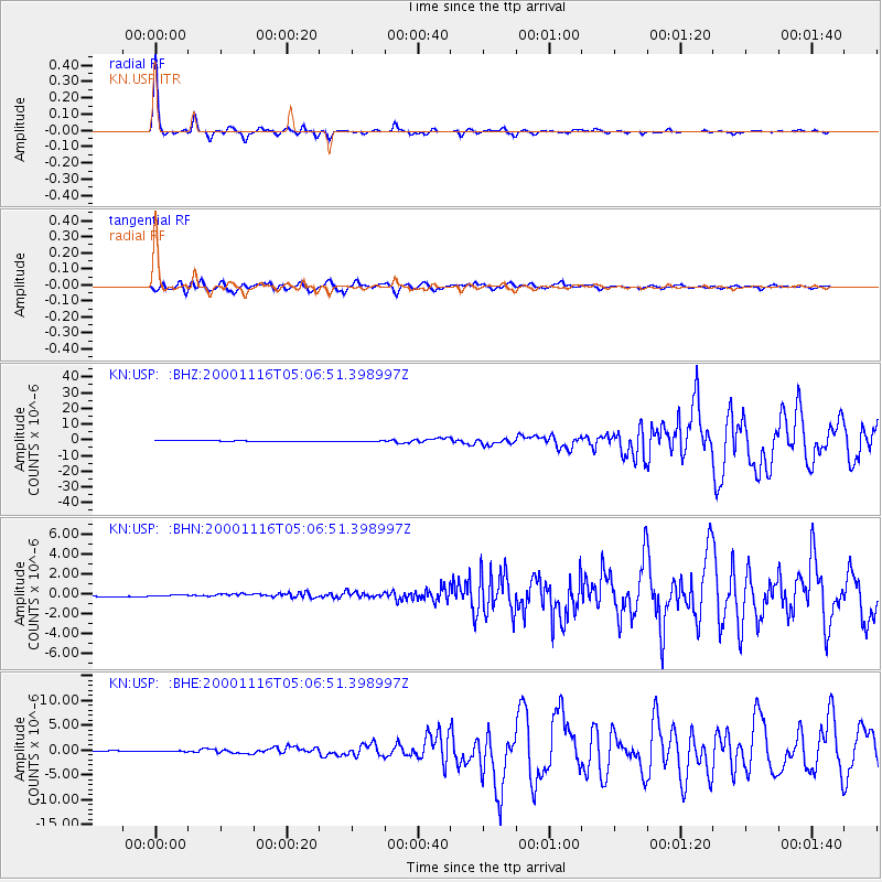
Earthquake location: New Ireland Region, P.N.G.
Earthquake latitude/longitude: -4.0/152.2
Earthquake time(UTC): 2000/11/16 (321) 04:54:56 GMT
Earthquake Depth: 33 km
Earthquake Magnitude: 6.0 MB, 8.2 MS, 8.0 MW, 8.0 ME
Earthquake Catalog/Contributor: WHDF/NEIC
Network: KN Kyrgyz Seismic Telemetry Network
Station: USP KN.USP
Lat/Lon: 43.27 N/74.50 E
Elevation: 740 m
Distance: 83.8 deg
Az: 314.123 deg
Baz: 101.363 deg
Ray Param: 0.045908246
Estimated Moho Depth: 47.25 km
Estimated Crust Vp/Vs: 1.80
Assumed Crust Vp: 6.306 km/s
Estimated Crust Vs: 3.503 km/s
Estimated Crust Poisson's Ratio: 0.28
Radial Match: 97.18847 %
Radial Bump: 214
Transverse Match: 79.762596 %
Transverse Bump: 400
SOD ConfigId: 3744
Insert Time: 2010-03-08 22:21:52.832 +0000
GWidth: 2.5
Max Bumps: 400
Tol: 0.001

Signal To Noise

ChannelStoNSTALTA
KN:USP: :BHN:20001116T05:06:51.398997Z0.81495642.5212748E-73.0937542E-7
KN:USP: :BHE:20001116T05:06:51.398997Z1.20236977.484969E-86.225181E-8
KN:USP: :BHZ:20001116T05:06:51.398997Z1.26908732.239064E-71.7643104E-7
Arrivals
Ps6.1 SECOND
PpPs20 SECOND
PsPs/PpSs27 SECOND