You are here: Home > Network List > TA - USArray Transportable Network (new EarthScope stations) Stations List
> Station G31M Satah River, YT, CAN > Earthquake Result Viewer
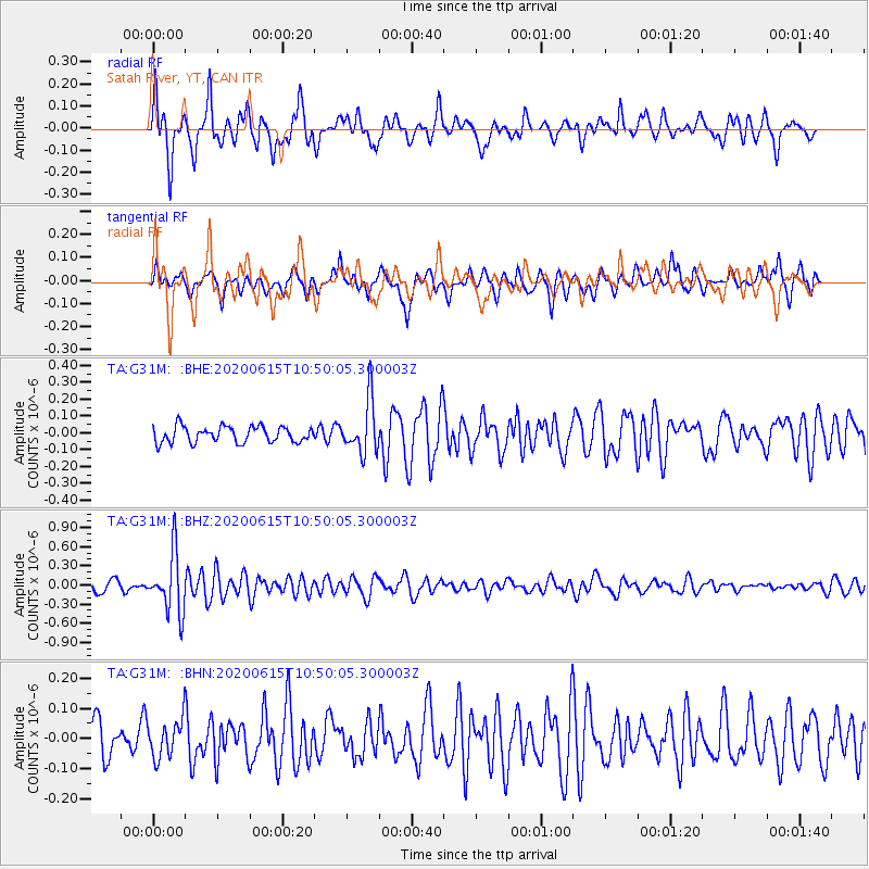
G31M Satah River, YT, CAN - Earthquake Result Viewer
*The percent match for this event was below the threshold and hence no stack was calculated.
| Earthquake location: |
Solomon Islands |
| Earthquake latitude/longitude: |
-9.5/156.1 |
| Earthquake time(UTC): |
2020/06/15 (167) 10:37:33 GMT |
| Earthquake Depth: |
10 km |
| Earthquake Magnitude: |
5.6 mb |
| Earthquake Catalog/Contributor: |
NEIC PDE/us |
|
| Network: |
TA USArray Transportable Network (new EarthScope stations) |
| Station: |
G31M Satah River, YT, CAN |
| Lat/Lon: |
66.92 N/134.27 W |
| Elevation: |
61 m |
|
| Distance: |
90.9 deg |
| Az: |
21.691 deg |
| Baz: |
247.664 deg |
| Ray Param: |
$rayparam |
*The percent match for this event was below the threshold and hence was not used in the summary stack. |
|
| Radial Match: |
68.26429 % |
| Radial Bump: |
400 |
| Transverse Match: |
59.001892 % |
| Transverse Bump: |
371 |
| SOD ConfigId: |
21709731 |
| Insert Time: |
2020-07-13 08:54:32.744 +0000 |
| GWidth: |
2.5 |
| Max Bumps: |
400 |
| Tol: |
0.001 |
|
Signal To Noise
| Channel | StoN | STA | LTA |
| TA:G31M: :BHZ:20200615T10:50:05.300003Z | 5.369247 | 4.660647E-7 | 8.6802615E-8 |
| TA:G31M: :BHN:20200615T10:50:05.300003Z | 1.0832158 | 6.16848E-8 | 5.6945993E-8 |
| TA:G31M: :BHE:20200615T10:50:05.300003Z | 3.3158622 | 1.5593523E-7 | 4.7027054E-8 |
| Arrivals |
| Ps | |
| PpPs | |
| PsPs/PpSs | |


