You are here: Home > Network List > PE - Penn State Network Stations List
> Station PAGS PA Geological Survey > Earthquake Result Viewer
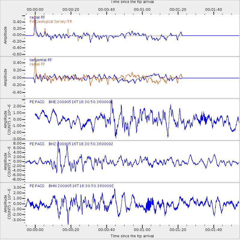
PAGS PA Geological Survey - Earthquake Result Viewer
*The percent match for this event was below the threshold and hence no stack was calculated.
| Earthquake location: |
Kodiak Island Region, Alaska |
| Earthquake latitude/longitude: |
56.4/-152.4 |
| Earthquake time(UTC): |
2009/05/16 (136) 18:22:25 GMT |
| Earthquake Depth: |
9.7 km |
| Earthquake Magnitude: |
5.9 MS, 5.4 MB, 5.9 MW, 5.8 MW |
| Earthquake Catalog/Contributor: |
WHDF/NEIC |
|
| Network: |
PE Penn State Network |
| Station: |
PAGS PA Geological Survey |
| Lat/Lon: |
40.23 N/76.72 W |
| Elevation: |
120 m |
|
| Distance: |
50.2 deg |
| Az: |
74.904 deg |
| Baz: |
315.535 deg |
| Ray Param: |
$rayparam |
*The percent match for this event was below the threshold and hence was not used in the summary stack. |
|
| Radial Match: |
69.91615 % |
| Radial Bump: |
400 |
| Transverse Match: |
31.874275 % |
| Transverse Bump: |
400 |
| SOD ConfigId: |
2760 |
| Insert Time: |
2010-02-26 14:56:16.132 +0000 |
| GWidth: |
2.5 |
| Max Bumps: |
400 |
| Tol: |
0.001 |
|
Signal To Noise
| Channel | StoN | STA | LTA |
| PE:PAGS: :BHZ:20090516T18:30:50.360009Z | 1.89289 | 8.08656E-7 | 4.2720708E-7 |
| PE:PAGS: :BHN:20090516T18:30:50.360009Z | 0.74293166 | 4.5888478E-7 | 6.176675E-7 |
| PE:PAGS: :BHE:20090516T18:30:50.360009Z | 1.4173155 | 9.170089E-7 | 6.470041E-7 |
| Arrivals |
| Ps | |
| PpPs | |
| PsPs/PpSs | |


