USP KN.USP - Earthquake Result Viewer
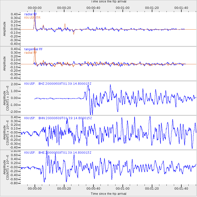
Earthquake location: New Britain Region, P.N.G.
Earthquake latitude/longitude: -5.1/152.5
Earthquake time(UTC): 2000/06/09 (161) 01:27:15 GMT
Earthquake Depth: 33 km
Earthquake Magnitude: 5.4 MB, 6.3 MS, 6.3 MW, 6.3 MW
Earthquake Catalog/Contributor: WHDF/NEIC
Network: KN Kyrgyz Seismic Telemetry Network
Station: USP KN.USP
Lat/Lon: 43.27 N/74.50 E
Elevation: 740 m
Distance: 84.8 deg
Az: 314.152 deg
Baz: 101.917 deg
Ray Param: 0.04521003
Estimated Moho Depth: 48.25 km
Estimated Crust Vp/Vs: 1.75
Assumed Crust Vp: 6.306 km/s
Estimated Crust Vs: 3.593 km/s
Estimated Crust Poisson's Ratio: 0.26
Radial Match: 97.183464 %
Radial Bump: 263
Transverse Match: 86.65625 %
Transverse Bump: 400
SOD ConfigId: 3744
Insert Time: 2010-03-08 22:22:49.005 +0000
GWidth: 2.5
Max Bumps: 400
Tol: 0.001

Signal To Noise

ChannelStoNSTALTA
KN:USP: :BHN:20000609T01:39:14.800015Z1.18533994.2258744E-83.565116E-8
KN:USP: :BHE:20000609T01:39:14.800015Z4.1855311.12023145E-72.6764381E-8
KN:USP: :BHZ:20000609T01:39:14.800015Z9.436473.4029824E-73.6062026E-8
Arrivals
Ps5.9 SECOND
PpPs21 SECOND
PsPs/PpSs26 SECOND