USP KN.USP - Earthquake Result Viewer
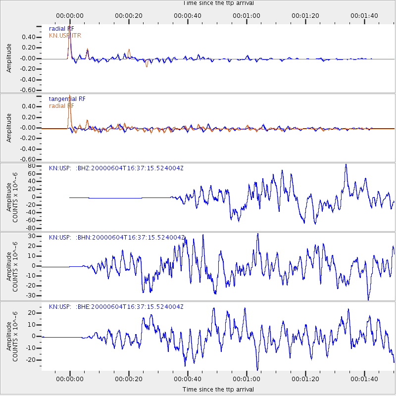
Earthquake location: Southern Sumatra, Indonesia
Earthquake latitude/longitude: -4.7/102.1
Earthquake time(UTC): 2000/06/04 (156) 16:28:26 GMT
Earthquake Depth: 33 km
Earthquake Magnitude: 6.8 MB, 8.0 MS, 7.9 MW, 7.7 MW
Earthquake Catalog/Contributor: WHDF/NEIC
Network: KN Kyrgyz Seismic Telemetry Network
Station: USP KN.USP
Lat/Lon: 43.27 N/74.50 E
Elevation: 740 m
Distance: 53.9 deg
Az: 335.245 deg
Baz: 145.156 deg
Ray Param: 0.06573798
Estimated Moho Depth: 54.75 km
Estimated Crust Vp/Vs: 1.66
Assumed Crust Vp: 6.306 km/s
Estimated Crust Vs: 3.799 km/s
Estimated Crust Poisson's Ratio: 0.22
Radial Match: 97.98587 %
Radial Bump: 259
Transverse Match: 88.86458 %
Transverse Bump: 400
SOD ConfigId: 3744
Insert Time: 2010-03-08 22:22:51.686 +0000
GWidth: 2.5
Max Bumps: 400
Tol: 0.001

Signal To Noise

ChannelStoNSTALTA
KN:USP: :BHN:20000604T16:37:15.524004Z6.14976555.56222E-79.044605E-8
KN:USP: :BHE:20000604T16:37:15.524004Z2.74308923.1102596E-71.1338529E-7
KN:USP: :BHZ:20000604T16:37:15.524004Z5.35306551.1416244E-62.1326552E-7
Arrivals
Ps6.1 SECOND
PpPs22 SECOND
PsPs/PpSs28 SECOND