
USP KN.USP - Earthquake Result Viewer
| ||||||||||||||||||
| ||||||||||||||||||
| ||||||||||||||||||
|
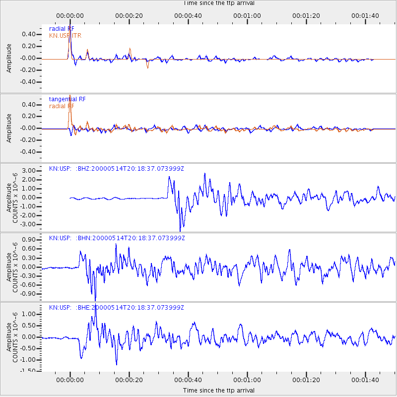
Signal To Noise
| Channel | StoN | STA | LTA |
| KN:USP: :BHN:20000514T20:18:37.073999Z | 8.374648 | 2.1692475E-7 | 2.5902551E-8 |
| KN:USP: :BHE:20000514T20:18:37.073999Z | 13.110777 | 3.703623E-7 | 2.824869E-8 |
| KN:USP: :BHZ:20000514T20:18:37.073999Z | 14.549204 | 9.249943E-7 | 6.357697E-8 |
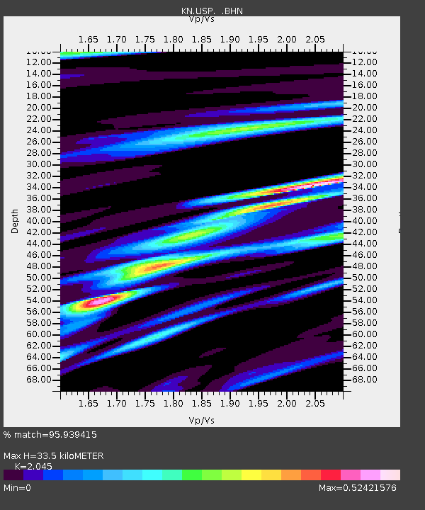
| Arrivals | |
| Ps | 5.8 SECOND |
| PpPs | 16 SECOND |
| PsPs/PpSs | 21 SECOND |

