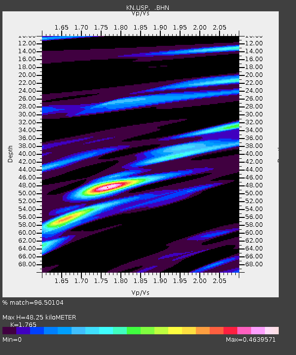
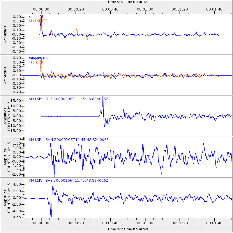
USP KN.USP - Earthquake Result Viewer

Earthquake location: New Britain Region, P.N.G.
Earthquake latitude/longitude: -5.8/150.9
Earthquake time(UTC): 2000/02/06 (037) 11:33:52 GMT
Earthquake Depth: 33 km
Earthquake Magnitude: 6.6 MB, 6.8 MS, 6.6 MW, 6.3 ME
Earthquake Catalog/Contributor: WHDF/NEIC
Network: KN Kyrgyz Seismic Telemetry Network
Station: USP KN.USP
Lat/Lon: 43.27 N/74.50 E
Elevation: 740 m
Distance: 84.1 deg
Az: 314.468 deg
Baz: 103.601 deg
Ray Param: 0.04564983
Estimated Moho Depth: 48.25 km
Estimated Crust Vp/Vs: 1.76
Assumed Crust Vp: 6.306 km/s
Estimated Crust Vs: 3.573 km/s
Estimated Crust Poisson's Ratio: 0.26
Radial Match: 96.50104 %
Radial Bump: 281
Transverse Match: 90.23475 %
Transverse Bump: 400
SOD ConfigId: 3744
Insert Time: 2010-03-08 22:22:56.986 +0000
GWidth: 2.5
Max Bumps: 400
Tol: 0.001

Signal To Noise

ChannelStoNSTALTA
KN:USP: :BHN:20000206T11:45:48.824006Z2.5189871.6621134E-76.59834E-8
KN:USP: :BHE:20000206T11:45:48.824006Z13.6396346.6565315E-74.880286E-8
KN:USP: :BHZ:20000206T11:45:48.824006Z35.4748152.1210499E-65.97903E-8
Arrivals
Ps6.0 SECOND
PpPs21 SECOND
PsPs/PpSs27 SECOND