
USP KN.USP - Earthquake Result Viewer
| ||||||||||||||||||
| ||||||||||||||||||
| ||||||||||||||||||
|
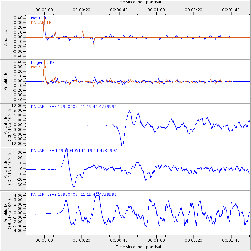
Signal To Noise
| Channel | StoN | STA | LTA |
| KN:USP: :BHN:19990405T11:19:41.473999Z | 2.3614616 | 3.968084E-7 | 1.6803507E-7 |
| KN:USP: :BHE:19990405T11:19:41.473999Z | 0.963961 | 4.2405077E-8 | 4.399045E-8 |
| KN:USP: :BHZ:19990405T11:19:41.473999Z | 3.080552 | 2.0998078E-7 | 6.816336E-8 |
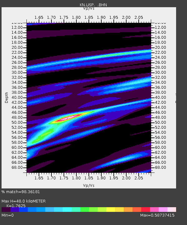
| Arrivals | |
| Ps | 5.9 SECOND |
| PpPs | 21 SECOND |
| PsPs/PpSs | 26 SECOND |

