
USP KN.USP - Earthquake Result Viewer
| ||||||||||||||||||
| ||||||||||||||||||
| ||||||||||||||||||
|
Signal To Noise
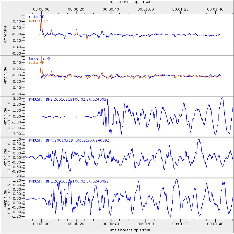
| Channel | StoN | STA | LTA |
| KN:USP: :BHN:20010319T06:02:36.624009Z | 1.680219 | 1.656087E-7 | 9.856375E-8 |
| KN:USP: :BHE:20010319T06:02:36.624009Z | 4.174638 | 1.9814497E-7 | 4.7463995E-8 |
| KN:USP: :BHZ:20010319T06:02:36.624009Z | 9.64064 | 4.6518193E-7 | 4.8252183E-8 |
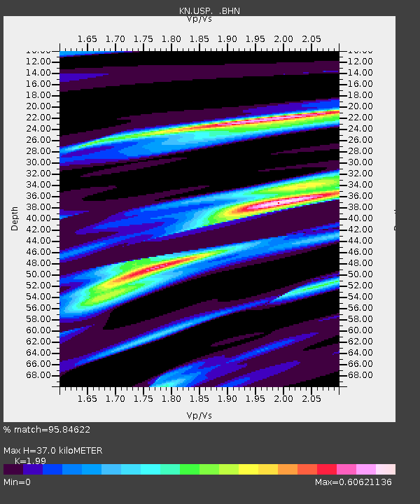
| Arrivals | |
| Ps | 6.0 SECOND |
| PpPs | 17 SECOND |
| PsPs/PpSs | 23 SECOND |

