You are here: Home > Network List > GS - US Geological Survey Networks Stations List
> Station KAN10 Keim Farm > Earthquake Result Viewer
KAN10 Keim Farm - Earthquake Result Viewer
*The percent match for this event was below the threshold and hence no stack was calculated.
| Earthquake location: |
Fiji Islands Region |
| Earthquake latitude/longitude: |
-19.7/-176.5 |
| Earthquake time(UTC): |
2017/06/25 (176) 17:42:30 GMT |
| Earthquake Depth: |
38 km |
| Earthquake Magnitude: |
6.2 Mww |
| Earthquake Catalog/Contributor: |
NEIC PDE/us |
|
| Network: |
GS US Geological Survey Networks |
| Station: |
KAN10 Keim Farm |
| Lat/Lon: |
37.12 N/98.10 W |
| Elevation: |
417 m |
|
| Distance: |
92.8 deg |
| Az: |
51.611 deg |
| Baz: |
247.54 deg |
| Ray Param: |
$rayparam |
*The percent match for this event was below the threshold and hence was not used in the summary stack. |
|
| Radial Match: |
18.501776 % |
| Radial Bump: |
245 |
| Transverse Match: |
20.114073 % |
| Transverse Bump: |
246 |
| SOD ConfigId: |
2140511 |
| Insert Time: |
2017-07-09 09:35:25.982 +0000 |
| GWidth: |
2.5 |
| Max Bumps: |
400 |
| Tol: |
0.001 |
|
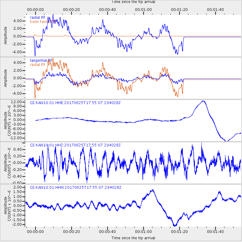
Signal To Noise
| Channel | StoN | STA | LTA |
| GS:KAN10:01:HHZ:20170625T17:55:07.294028Z | 1.2888058 | 1.4218999E-7 | 1.1032693E-7 |
| GS:KAN10:01:HHN:20170625T17:55:07.294028Z | 0.96878576 | 6.060318E-7 | 6.2555813E-7 |
| GS:KAN10:01:HHE:20170625T17:55:07.294028Z | 3.1640835 | 1.6376978E-6 | 5.175899E-7 |
| Arrivals |
| Ps | |
| PpPs | |
| PsPs/PpSs | |


