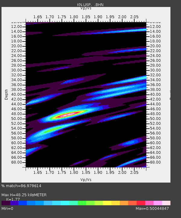
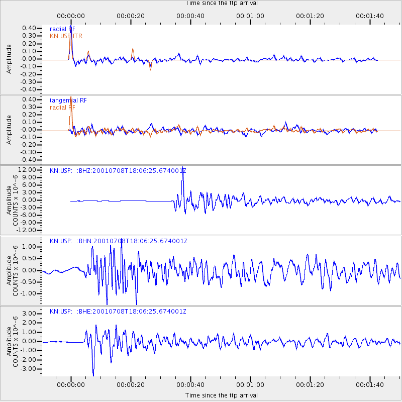
USP KN.USP - Earthquake Result Viewer

Earthquake location: New Britain Region, P.N.G.
Earthquake latitude/longitude: -6.7/152.1
Earthquake time(UTC): 2001/07/08 (189) 17:54:18 GMT
Earthquake Depth: 10 km
Earthquake Magnitude: 6.0 MB, 5.7 MS, 6.2 MW, 5.7 ML
Earthquake Catalog/Contributor: WHDF/NEIC
Network: KN Kyrgyz Seismic Telemetry Network
Station: USP KN.USP
Lat/Lon: 43.27 N/74.50 E
Elevation: 740 m
Distance: 85.6 deg
Az: 314.31 deg
Baz: 103.324 deg
Ray Param: 0.044659242
Estimated Moho Depth: 48.25 km
Estimated Crust Vp/Vs: 1.77
Assumed Crust Vp: 6.306 km/s
Estimated Crust Vs: 3.563 km/s
Estimated Crust Poisson's Ratio: 0.27
Radial Match: 96.979614 %
Radial Bump: 348
Transverse Match: 88.693634 %
Transverse Bump: 400
SOD ConfigId: 4714
Insert Time: 2010-03-08 22:24:40.268 +0000
GWidth: 2.5
Max Bumps: 400
Tol: 0.001

Signal To Noise

ChannelStoNSTALTA
KN:USP: :BHN:20010708T18:06:25.674001Z1.64947371.2422582E-77.53124E-8
KN:USP: :BHE:20010708T18:06:25.674001Z2.47034811.2617969E-75.10777E-8
KN:USP: :BHZ:20010708T18:06:25.674001Z9.0068584.992537E-75.5430398E-8
Arrivals
Ps6.0 SECOND
PpPs21 SECOND
PsPs/PpSs27 SECOND