You are here: Home > Network List > II - Global Seismograph Network (GSN - IRIS/IDA) Stations List
> Station WRAB Tennant Creek, NT, Australia > Earthquake Result Viewer
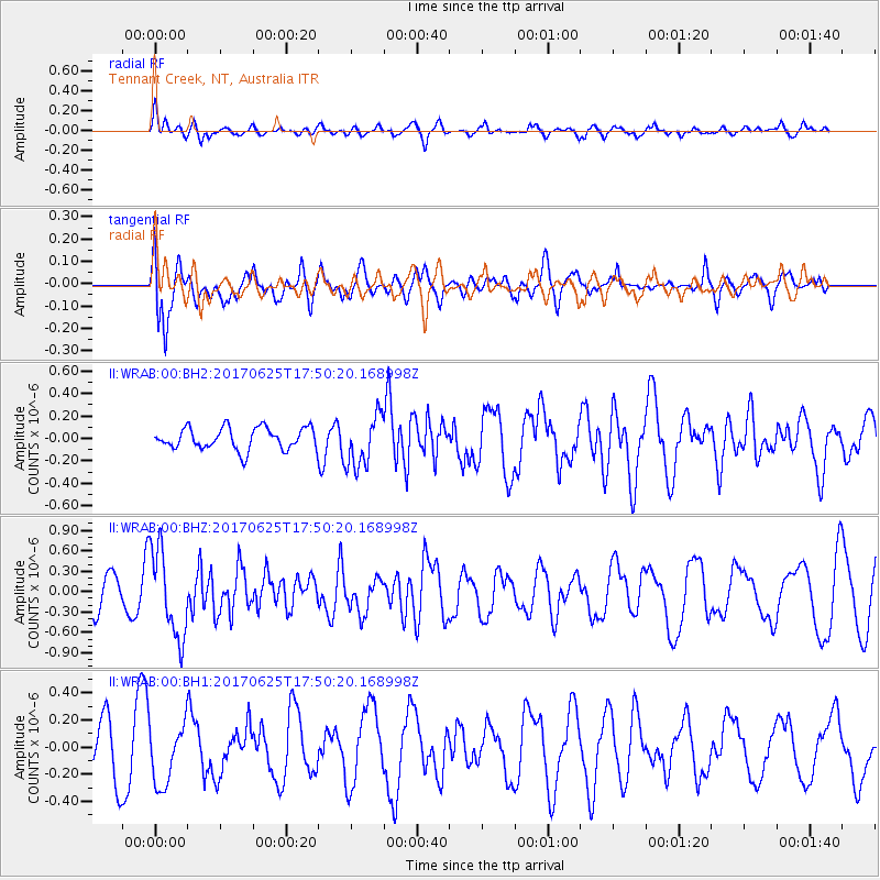
WRAB Tennant Creek, NT, Australia - Earthquake Result Viewer
*The percent match for this event was below the threshold and hence no stack was calculated.
| Earthquake location: |
Fiji Islands Region |
| Earthquake latitude/longitude: |
-19.7/-176.5 |
| Earthquake time(UTC): |
2017/06/25 (176) 17:42:30 GMT |
| Earthquake Depth: |
38 km |
| Earthquake Magnitude: |
6.2 Mww |
| Earthquake Catalog/Contributor: |
NEIC PDE/us |
|
| Network: |
II Global Seismograph Network (GSN - IRIS/IDA) |
| Station: |
WRAB Tennant Creek, NT, Australia |
| Lat/Lon: |
19.93 S/134.36 E |
| Elevation: |
366 m |
|
| Distance: |
46.1 deg |
| Az: |
260.932 deg |
| Baz: |
98.451 deg |
| Ray Param: |
$rayparam |
*The percent match for this event was below the threshold and hence was not used in the summary stack. |
|
| Radial Match: |
50.743084 % |
| Radial Bump: |
400 |
| Transverse Match: |
65.0941 % |
| Transverse Bump: |
400 |
| SOD ConfigId: |
2140511 |
| Insert Time: |
2017-07-09 09:35:59.246 +0000 |
| GWidth: |
2.5 |
| Max Bumps: |
400 |
| Tol: |
0.001 |
|
Signal To Noise
| Channel | StoN | STA | LTA |
| II:WRAB:00:BHZ:20170625T17:50:20.168998Z | 2.437338 | 6.471258E-7 | 2.6550515E-7 |
| II:WRAB:00:BH1:20170625T17:50:20.168998Z | 1.1311882 | 2.248736E-7 | 1.9879418E-7 |
| II:WRAB:00:BH2:20170625T17:50:20.168998Z | 2.3724158 | 2.3030167E-7 | 9.707475E-8 |
| Arrivals |
| Ps | |
| PpPs | |
| PsPs/PpSs | |


