USP KN.USP - Earthquake Result Viewer
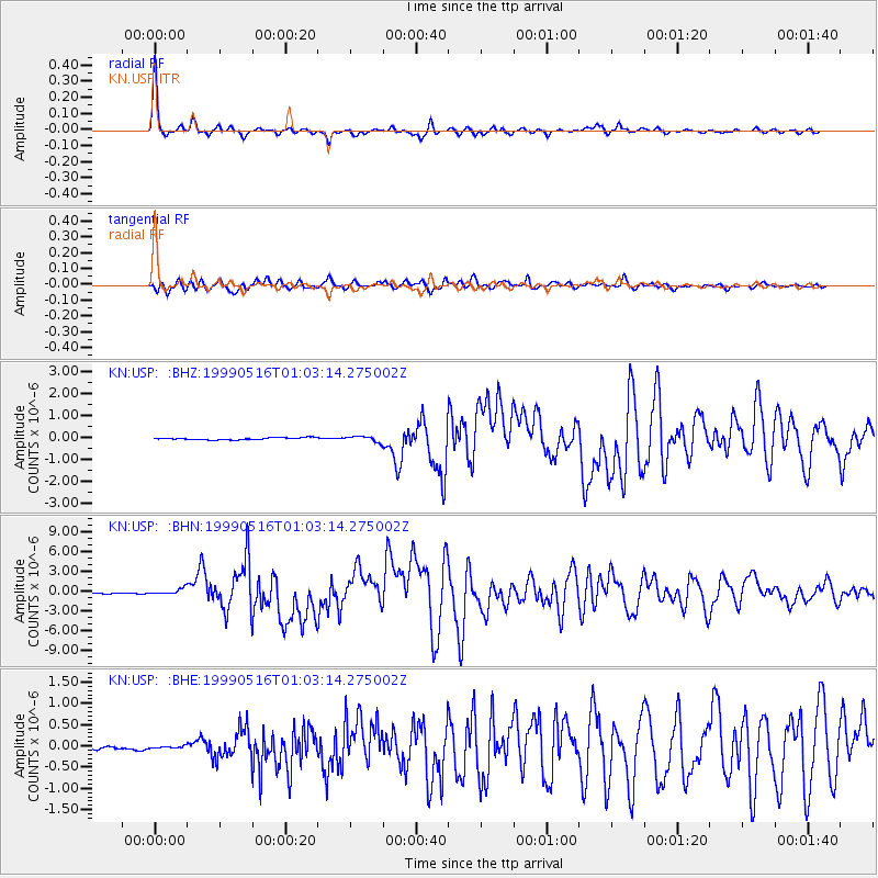
Earthquake location: New Britain Region, P.N.G.
Earthquake latitude/longitude: -4.8/152.5
Earthquake time(UTC): 1999/05/16 (136) 00:51:20 GMT
Earthquake Depth: 74 km
Earthquake Magnitude: 6.0 MB, 7.0 MS, 7.1 MW, 6.3 ME
Earthquake Catalog/Contributor: WHDF/NEIC
Network: KN Kyrgyz Seismic Telemetry Network
Station: USP KN.USP
Lat/Lon: 43.27 N/74.50 E
Elevation: 740 m
Distance: 84.5 deg
Az: 314.132 deg
Baz: 101.695 deg
Ray Param: 0.045270104
Estimated Moho Depth: 48.25 km
Estimated Crust Vp/Vs: 1.77
Assumed Crust Vp: 6.306 km/s
Estimated Crust Vs: 3.558 km/s
Estimated Crust Poisson's Ratio: 0.27
Radial Match: 97.33909 %
Radial Bump: 254
Transverse Match: 90.97676 %
Transverse Bump: 400
SOD ConfigId: 4480
Insert Time: 2010-03-08 22:25:04.372 +0000
GWidth: 2.5
Max Bumps: 400
Tol: 0.001

Signal To Noise

ChannelStoNSTALTA
KN:USP: :BHN:19990516T01:03:14.275002Z7.871044.394525E-75.5831567E-8
KN:USP: :BHE:19990516T01:03:14.275002Z0.783478142.2283809E-82.8442157E-8
KN:USP: :BHZ:19990516T01:03:14.275002Z2.63454061.294814E-74.9147626E-8
Arrivals
Ps6.1 SECOND
PpPs21 SECOND
PsPs/PpSs27 SECOND