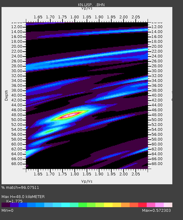
USP KN.USP - Earthquake Result Viewer
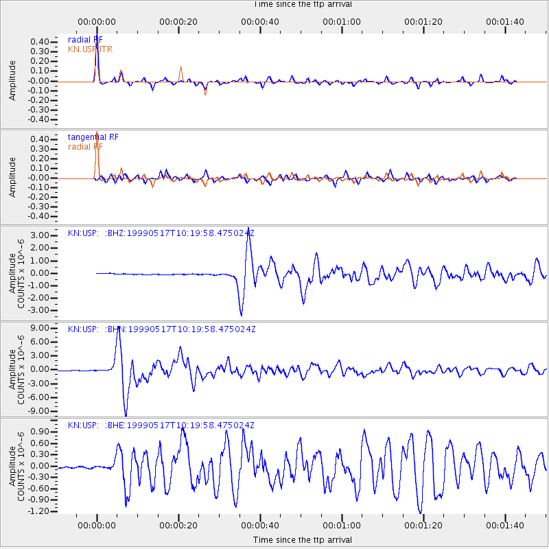
Earthquake location: New Britain Region, P.N.G.
Earthquake latitude/longitude: -5.2/152.9
Earthquake time(UTC): 1999/05/17 (137) 10:07:56 GMT
Earthquake Depth: 27 km
Earthquake Magnitude: 5.5 MB, 6.9 MS, 6.7 MW, 6.0 ME
Earthquake Catalog/Contributor: WHDF/NEIC
Network: KN Kyrgyz Seismic Telemetry Network
Station: USP KN.USP
Lat/Lon: 43.27 N/74.50 E
Elevation: 740 m
Distance: 85.1 deg
Az: 314.101 deg
Baz: 101.719 deg
Ray Param: 0.04497914
Estimated Moho Depth: 48.0 km
Estimated Crust Vp/Vs: 1.77
Assumed Crust Vp: 6.306 km/s
Estimated Crust Vs: 3.553 km/s
Estimated Crust Poisson's Ratio: 0.27
Radial Match: 96.07511 %
Radial Bump: 215
Transverse Match: 87.19441 %
Transverse Bump: 400
SOD ConfigId: 4480
Insert Time: 2010-03-08 22:25:10.267 +0000
GWidth: 2.5
Max Bumps: 400
Tol: 0.001

Signal To Noise

ChannelStoNSTALTA
KN:USP: :BHN:19990517T10:19:58.475024Z34.3885461.5649538E-64.5507996E-8
KN:USP: :BHE:19990517T10:19:58.475024Z2.69189761.0221314E-73.7970665E-8
KN:USP: :BHZ:19990517T10:19:58.475024Z12.8762864.776824E-73.709784E-8
Arrivals
Ps6.0 SECOND
PpPs21 SECOND
PsPs/PpSs27 SECOND