USP KN.USP - Earthquake Result Viewer
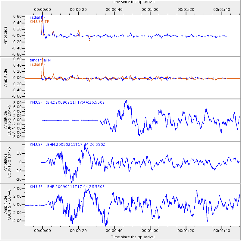
Earthquake location: Talaud Islands, Indonesia
Earthquake latitude/longitude: 3.9/126.4
Earthquake time(UTC): 2009/02/11 (042) 17:34:50 GMT
Earthquake Depth: 22 km
Earthquake Magnitude: 6.6 MB, 7.2 MS, 7.2 MW, 7.1 MW
Earthquake Catalog/Contributor: WHDF/NEIC
Network: KN Kyrgyz Seismic Telemetry Network
Station: USP KN.USP
Lat/Lon: 43.27 N/74.50 E
Elevation: 740 m
Distance: 60.3 deg
Az: 318.56 deg
Baz: 115.312 deg
Ray Param: 0.06160525
Estimated Moho Depth: 47.0 km
Estimated Crust Vp/Vs: 1.81
Assumed Crust Vp: 6.306 km/s
Estimated Crust Vs: 3.494 km/s
Estimated Crust Poisson's Ratio: 0.28
Radial Match: 97.468376 %
Radial Bump: 285
Transverse Match: 92.48217 %
Transverse Bump: 400
SOD ConfigId: 2658
Insert Time: 2010-03-08 22:25:14.912 +0000
GWidth: 2.5
Max Bumps: 400
Tol: 0.001

Signal To Noise

ChannelStoNSTALTA
KN:USP: :BHN:20090211T17:44:26.550Z31.9304712.007305E-66.286487E-8
KN:USP: :BHE:20090211T17:44:26.550Z4.9494163.9918177E-78.065229E-8
KN:USP: :BHZ:20090211T17:44:26.550Z13.2854398.1895763E-76.164325E-8
Arrivals
Ps6.3 SECOND
PpPs20 SECOND
PsPs/PpSs26 SECOND