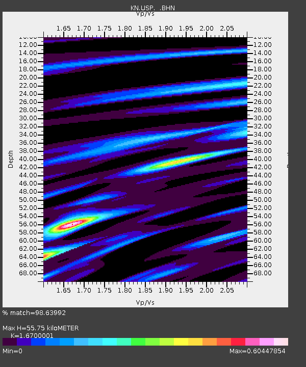
USP KN.USP - Earthquake Result Viewer
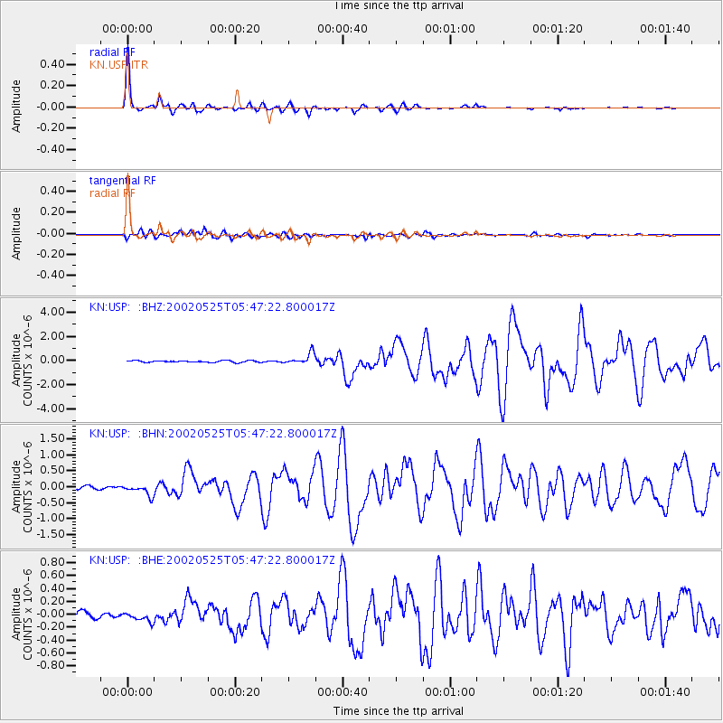
Earthquake location: South Of Alaska
Earthquake latitude/longitude: 53.8/-161.1
Earthquake time(UTC): 2002/05/25 (145) 05:36:31 GMT
Earthquake Depth: 33 km
Earthquake Magnitude: 5.5 MB, 6.1 MS, 6.5 MW, 6.4 MW
Earthquake Catalog/Contributor: WHDF/NEIC
Network: KN Kyrgyz Seismic Telemetry Network
Station: USP KN.USP
Lat/Lon: 43.27 N/74.50 E
Elevation: 740 m
Distance: 72.2 deg
Az: 320.724 deg
Baz: 30.924 deg
Ray Param: 0.05375427
Estimated Moho Depth: 55.75 km
Estimated Crust Vp/Vs: 1.67
Assumed Crust Vp: 6.306 km/s
Estimated Crust Vs: 3.776 km/s
Estimated Crust Poisson's Ratio: 0.22
Radial Match: 98.63992 %
Radial Bump: 258
Transverse Match: 91.753136 %
Transverse Bump: 400
SOD ConfigId: 20082
Insert Time: 2010-03-08 22:25:23.824 +0000
GWidth: 2.5
Max Bumps: 400
Tol: 0.001

Signal To Noise

ChannelStoNSTALTA
KN:USP: :BHN:20020525T05:47:22.800017Z2.82921771.6340063E-75.77547E-8
KN:USP: :BHE:20020525T05:47:22.800017Z2.00681196.998559E-83.4874017E-8
KN:USP: :BHZ:20020525T05:47:22.800017Z6.7674184.6732046E-76.905447E-8
Arrivals
Ps6.1 SECOND
PpPs23 SECOND
PsPs/PpSs29 SECOND