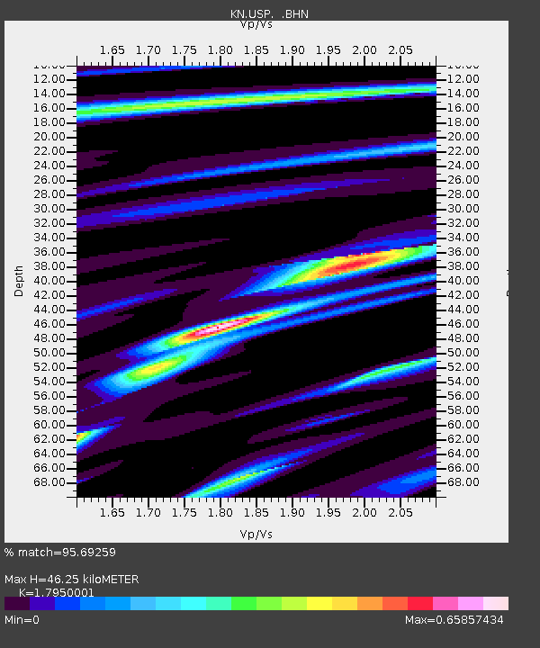
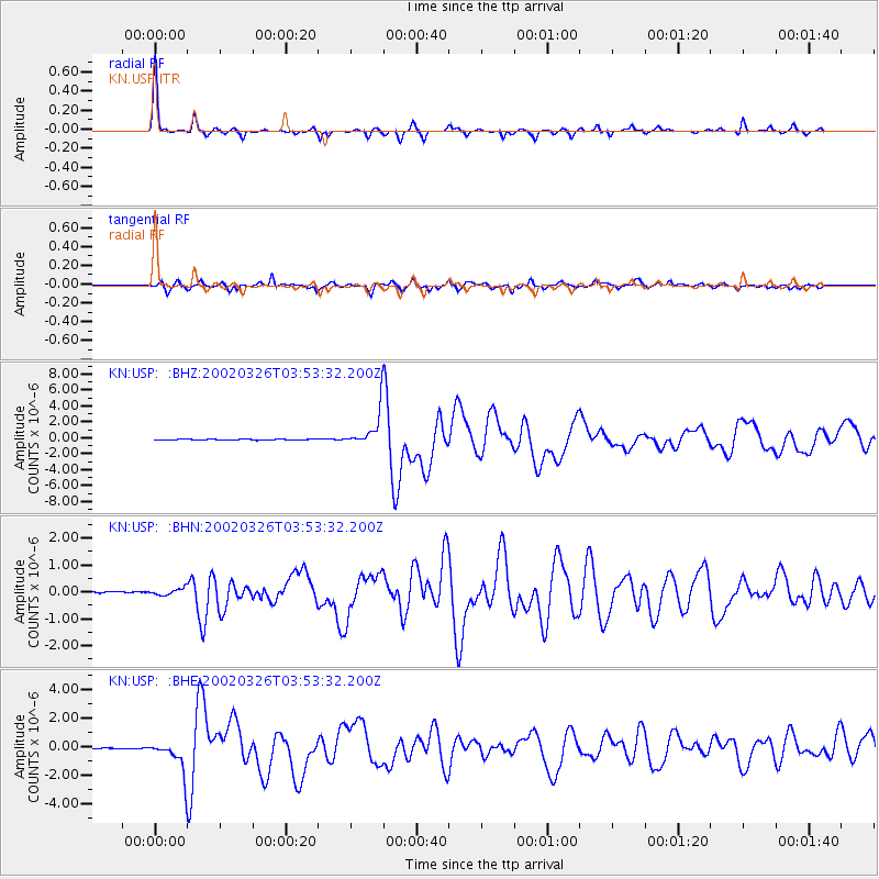
USP KN.USP - Earthquake Result Viewer

Earthquake location: Southwestern Ryukyu Isl., Japan
Earthquake latitude/longitude: 23.3/124.1
Earthquake time(UTC): 2002/03/26 (085) 03:45:48 GMT
Earthquake Depth: 33 km
Earthquake Magnitude: 5.8 MB, 6.6 MS, 6.4 MW, 6.4 MW
Earthquake Catalog/Contributor: WHDF/NEIC
Network: KN Kyrgyz Seismic Telemetry Network
Station: USP KN.USP
Lat/Lon: 43.27 N/74.50 E
Elevation: 740 m
Distance: 45.2 deg
Az: 308.417 deg
Baz: 99.656 deg
Ray Param: 0.07135071
Estimated Moho Depth: 46.25 km
Estimated Crust Vp/Vs: 1.80
Assumed Crust Vp: 6.306 km/s
Estimated Crust Vs: 3.513 km/s
Estimated Crust Poisson's Ratio: 0.27
Radial Match: 95.69259 %
Radial Bump: 203
Transverse Match: 89.52448 %
Transverse Bump: 368
SOD ConfigId: 20082
Insert Time: 2010-03-08 22:25:35.025 +0000
GWidth: 2.5
Max Bumps: 400
Tol: 0.001

Signal To Noise

ChannelStoNSTALTA
KN:USP: :BHN:20020326T03:53:32.200Z2.56290961.283632E-75.0084946E-8
KN:USP: :BHE:20020326T03:53:32.200Z27.7110161.089084E-63.9301483E-8
KN:USP: :BHZ:20020326T03:53:32.200Z43.841912.2909367E-65.2254485E-8
Arrivals
Ps6.2 SECOND
PpPs19 SECOND
PsPs/PpSs25 SECOND