
USP KN.USP - Earthquake Result Viewer
| ||||||||||||||||||
| ||||||||||||||||||
| ||||||||||||||||||
|
Signal To Noise
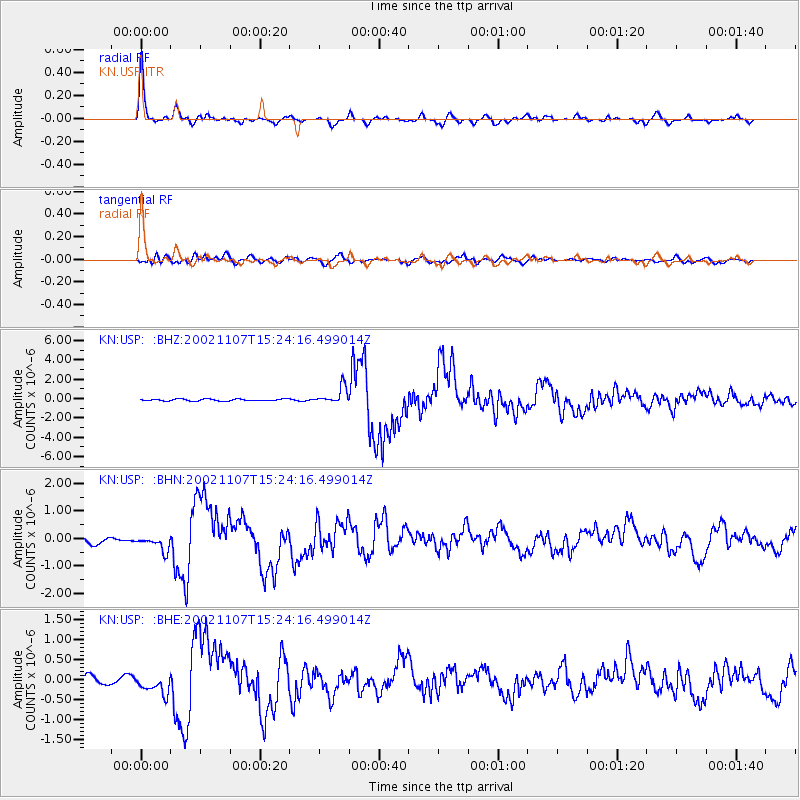
| Channel | StoN | STA | LTA |
| KN:USP: :BHN:20021107T15:24:16.499014Z | 2.7084289 | 3.0618807E-7 | 1.1305007E-7 |
| KN:USP: :BHE:20021107T15:24:16.499014Z | 1.871275 | 2.4396067E-7 | 1.3037136E-7 |
| KN:USP: :BHZ:20021107T15:24:16.499014Z | 9.054758 | 8.784943E-7 | 9.7020184E-8 |
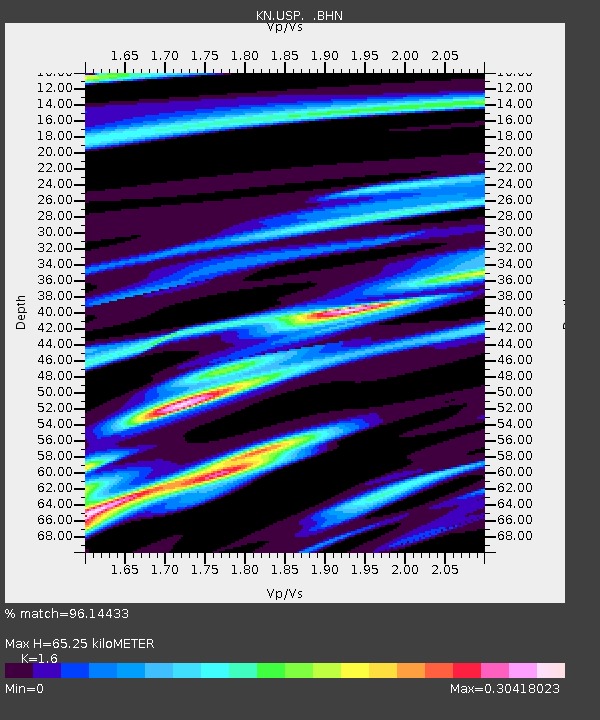
| Arrivals | |
| Ps | 6.5 SECOND |
| PpPs | 26 SECOND |
| PsPs/PpSs | 32 SECOND |

