You are here: Home > Network List > TA - USArray Transportable Network (new EarthScope stations) Stations List
> Station G16K Koyuk River, AK, USA > Earthquake Result Viewer
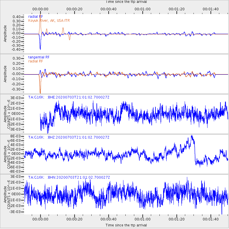
G16K Koyuk River, AK, USA - Earthquake Result Viewer
*The percent match for this event was below the threshold and hence no stack was calculated.
| Earthquake location: |
Mona Passage |
| Earthquake latitude/longitude: |
17.9/-67.0 |
| Earthquake time(UTC): |
2020/07/03 (185) 20:49:45 GMT |
| Earthquake Depth: |
3.0 km |
| Earthquake Magnitude: |
5.5 Mww |
| Earthquake Catalog/Contributor: |
NEIC PDE/pr |
|
| Network: |
TA USArray Transportable Network (new EarthScope stations) |
| Station: |
G16K Koyuk River, AK, USA |
| Lat/Lon: |
65.39 N/162.35 W |
| Elevation: |
169 m |
|
| Distance: |
76.1 deg |
| Az: |
334.567 deg |
| Baz: |
77.595 deg |
| Ray Param: |
$rayparam |
*The percent match for this event was below the threshold and hence was not used in the summary stack. |
|
| Radial Match: |
81.025856 % |
| Radial Bump: |
400 |
| Transverse Match: |
58.981144 % |
| Transverse Bump: |
400 |
| SOD ConfigId: |
21709731 |
| Insert Time: |
2020-07-17 21:06:01.290 +0000 |
| GWidth: |
2.5 |
| Max Bumps: |
400 |
| Tol: |
0.001 |
|
Signal To Noise
| Channel | StoN | STA | LTA |
| TA:G16K: :BHZ:20200703T21:01:02.700027Z | 0.40954912 | 1.8247096E-9 | 4.4554107E-9 |
| TA:G16K: :BHN:20200703T21:01:02.700027Z | 0.6632374 | 7.7627926E-10 | 1.1704396E-9 |
| TA:G16K: :BHE:20200703T21:01:02.700027Z | 0.7879283 | 9.492013E-10 | 1.2046798E-9 |
| Arrivals |
| Ps | |
| PpPs | |
| PsPs/PpSs | |


