You are here: Home > Network List > KN - Kyrgyz Seismic Telemetry Network Stations List
> Station USP KN.USP > Earthquake Result Viewer
USP KN.USP - Earthquake Result Viewer
| Earthquake location: |
Sunda Strait, Indonesia |
| Earthquake latitude/longitude: |
-7.0/104.2 |
| Earthquake time(UTC): |
2002/06/27 (178) 05:50:35 GMT |
| Earthquake Depth: |
11 km |
| Earthquake Magnitude: |
6.0 MB, 6.9 MS, 6.6 MW, 6.5 MW |
| Earthquake Catalog/Contributor: |
WHDF/NEIC |
|
| Network: |
KN Kyrgyz Seismic Telemetry Network |
| Station: |
USP KN.USP |
| Lat/Lon: |
43.27 N/74.50 E |
| Elevation: |
740 m |
|
| Distance: |
56.8 deg |
| Az: |
334.384 deg |
| Baz: |
144.016 deg |
| Ray Param: |
0.06391107 |
| Estimated Moho Depth: |
49.75 km |
| Estimated Crust Vp/Vs: |
1.69 |
| Assumed Crust Vp: |
6.306 km/s |
| Estimated Crust Vs: |
3.726 km/s |
| Estimated Crust Poisson's Ratio: |
0.23 |
|
| Radial Match: |
95.793236 % |
| Radial Bump: |
315 |
| Transverse Match: |
88.0962 % |
| Transverse Bump: |
400 |
| SOD ConfigId: |
20082 |
| Insert Time: |
2010-03-08 22:26:05.619 +0000 |
| GWidth: |
2.5 |
| Max Bumps: |
400 |
| Tol: |
0.001 |
|
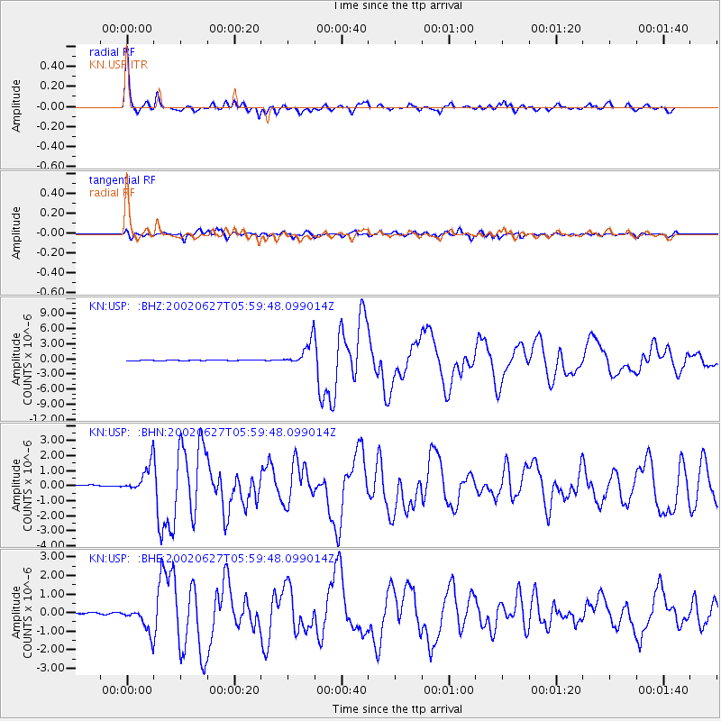
Signal To Noise
| Channel | StoN | STA | LTA |
| KN:USP: :BHN:20020627T05:59:48.099014Z | 7.7447643 | 1.0033284E-6 | 1.2954925E-7 |
| KN:USP: :BHE:20020627T05:59:48.099014Z | 12.874963 | 6.708987E-7 | 5.2108792E-8 |
| KN:USP: :BHZ:20020627T05:59:48.099014Z | 44.142853 | 2.5368188E-6 | 5.7468398E-8 |
| Arrivals |
| Ps | 5.7 SECOND |
| PpPs | 20 SECOND |
| PsPs/PpSs | 26 SECOND |


