You are here: Home > Network List > US - United States National Seismic Network Stations List
> Station HAWA Hanford, Washington, USA > Earthquake Result Viewer
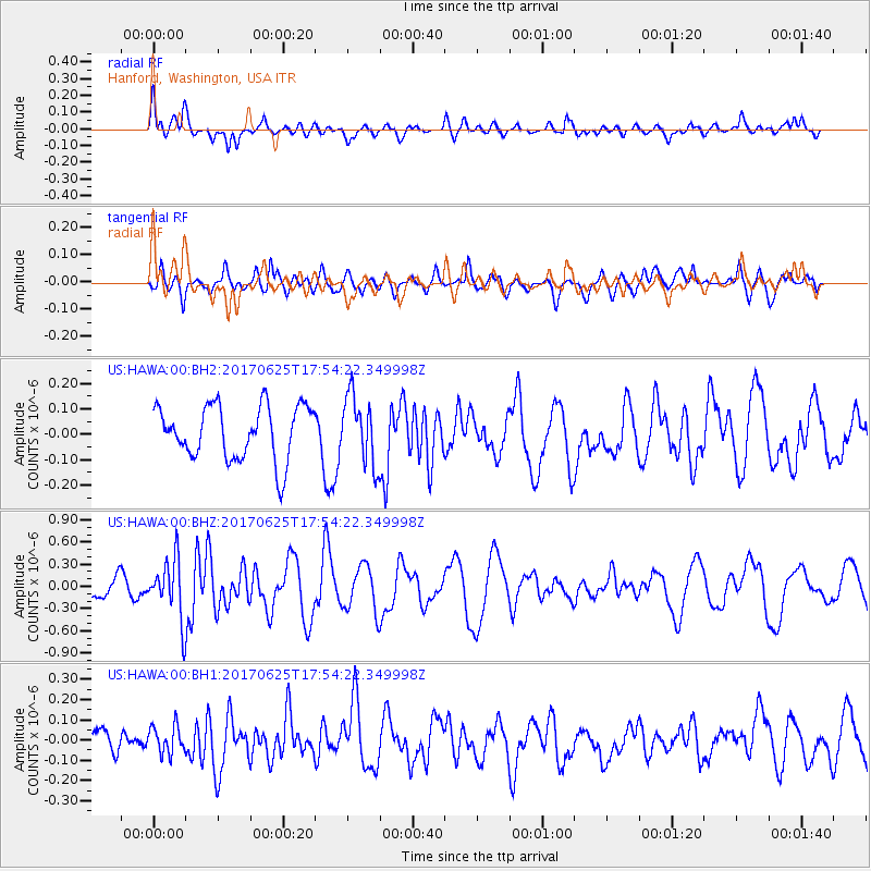
HAWA Hanford, Washington, USA - Earthquake Result Viewer
*The percent match for this event was below the threshold and hence no stack was calculated.
| Earthquake location: |
Fiji Islands Region |
| Earthquake latitude/longitude: |
-19.7/-176.5 |
| Earthquake time(UTC): |
2017/06/25 (176) 17:42:30 GMT |
| Earthquake Depth: |
38 km |
| Earthquake Magnitude: |
6.2 Mww |
| Earthquake Catalog/Contributor: |
NEIC PDE/us |
|
| Network: |
US United States National Seismic Network |
| Station: |
HAWA Hanford, Washington, USA |
| Lat/Lon: |
46.39 N/119.53 W |
| Elevation: |
364 m |
|
| Distance: |
83.4 deg |
| Az: |
35.722 deg |
| Baz: |
232.65 deg |
| Ray Param: |
$rayparam |
*The percent match for this event was below the threshold and hence was not used in the summary stack. |
|
| Radial Match: |
76.00529 % |
| Radial Bump: |
400 |
| Transverse Match: |
48.256916 % |
| Transverse Bump: |
400 |
| SOD ConfigId: |
2140511 |
| Insert Time: |
2017-07-09 09:37:18.562 +0000 |
| GWidth: |
2.5 |
| Max Bumps: |
400 |
| Tol: |
0.001 |
|
Signal To Noise
| Channel | StoN | STA | LTA |
| US:HAWA:00:BHZ:20170625T17:54:22.349998Z | 2.5395942 | 3.992183E-7 | 1.5719766E-7 |
| US:HAWA:00:BH1:20170625T17:54:22.349998Z | 1.0117363 | 6.799664E-8 | 6.7207864E-8 |
| US:HAWA:00:BH2:20170625T17:54:22.349998Z | 1.2631204 | 1.3341882E-7 | 1.0562638E-7 |
| Arrivals |
| Ps | |
| PpPs | |
| PsPs/PpSs | |


