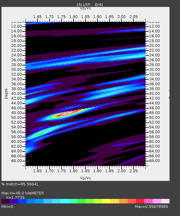
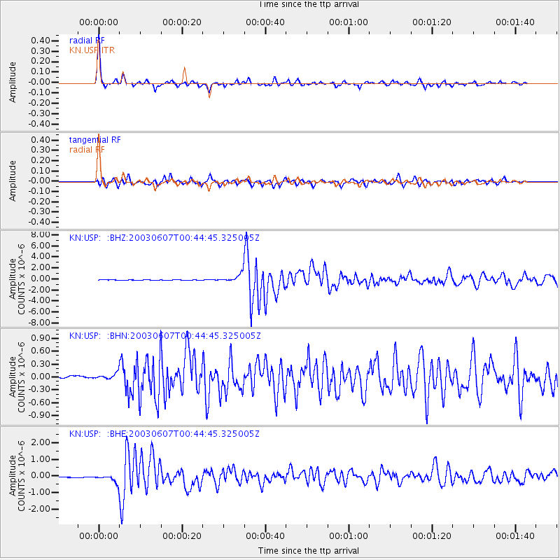
USP KN.USP - Earthquake Result Viewer

Earthquake location: New Britain Region, P.N.G.
Earthquake latitude/longitude: -5.1/152.5
Earthquake time(UTC): 2003/06/07 (158) 00:32:45 GMT
Earthquake Depth: 33 km
Earthquake Magnitude: 6.0 MB, 6.8 MS, 6.6 MW, 6.5 MW
Earthquake Catalog/Contributor: WHDF/NEIC
Network: KN Kyrgyz Seismic Telemetry Network
Station: USP KN.USP
Lat/Lon: 43.27 N/74.50 E
Elevation: 740 m
Distance: 84.8 deg
Az: 314.153 deg
Baz: 101.93 deg
Ray Param: 0.045194507
Estimated Moho Depth: 48.0 km
Estimated Crust Vp/Vs: 1.77
Assumed Crust Vp: 6.306 km/s
Estimated Crust Vs: 3.558 km/s
Estimated Crust Poisson's Ratio: 0.27
Radial Match: 95.56641 %
Radial Bump: 281
Transverse Match: 87.27004 %
Transverse Bump: 400
SOD ConfigId: 4714
Insert Time: 2010-03-08 22:26:31.923 +0000
GWidth: 2.5
Max Bumps: 400
Tol: 0.001

Signal To Noise

ChannelStoNSTALTA
KN:USP: :BHN:20030607T00:44:45.325005Z2.28916179.1117094E-83.9803695E-8
KN:USP: :BHE:20030607T00:44:45.325005Z4.97097442.6690097E-75.3691885E-8
KN:USP: :BHZ:20030607T00:44:45.325005Z22.0494678.811308E-73.996155E-8
Arrivals
Ps6.0 SECOND
PpPs21 SECOND
PsPs/PpSs27 SECOND