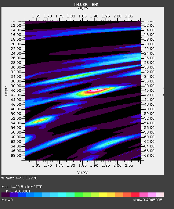
USP KN.USP - Earthquake Result Viewer
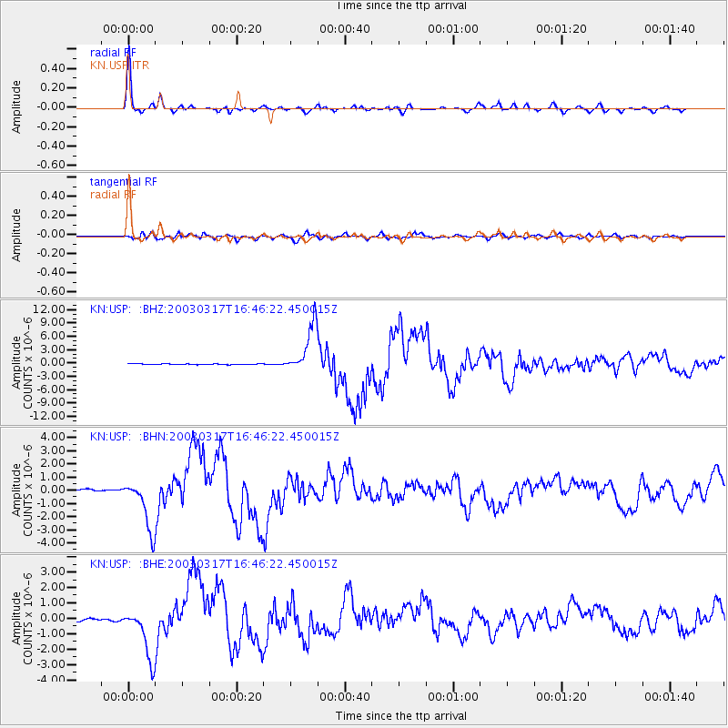
Earthquake location: Rat Islands, Aleutian Islands
Earthquake latitude/longitude: 51.3/178.0
Earthquake time(UTC): 2003/03/17 (076) 16:36:17 GMT
Earthquake Depth: 33 km
Earthquake Magnitude: 5.9 MB, 6.7 MS, 7.0 MW, 7.0 MW
Earthquake Catalog/Contributor: WHDF/NEIC
Network: KN Kyrgyz Seismic Telemetry Network
Station: USP KN.USP
Lat/Lon: 43.27 N/74.50 E
Elevation: 740 m
Distance: 64.9 deg
Az: 308.324 deg
Baz: 42.428 deg
Ray Param: 0.058581617
Estimated Moho Depth: 39.5 km
Estimated Crust Vp/Vs: 1.91
Assumed Crust Vp: 6.306 km/s
Estimated Crust Vs: 3.302 km/s
Estimated Crust Poisson's Ratio: 0.31
Radial Match: 98.12278 %
Radial Bump: 337
Transverse Match: 91.17389 %
Transverse Bump: 400
SOD ConfigId: 4714
Insert Time: 2010-03-08 22:26:36.291 +0000
GWidth: 2.5
Max Bumps: 400
Tol: 0.001

Signal To Noise

ChannelStoNSTALTA
KN:USP: :BHN:20030317T16:46:22.450015Z17.4855461.9033432E-61.0885237E-7
KN:USP: :BHE:20030317T16:46:22.450015Z22.1427671.6757192E-67.567795E-8
KN:USP: :BHZ:20030317T16:46:22.450015Z61.8774725.5779747E-69.0145484E-8
Arrivals
Ps5.9 SECOND
PpPs18 SECOND
PsPs/PpSs23 SECOND