You are here: Home > Network List > AV - Alaska Volcano Observatory Stations List
> Station PLBL Mt. Peulik Volcano, Alaska > Earthquake Result Viewer
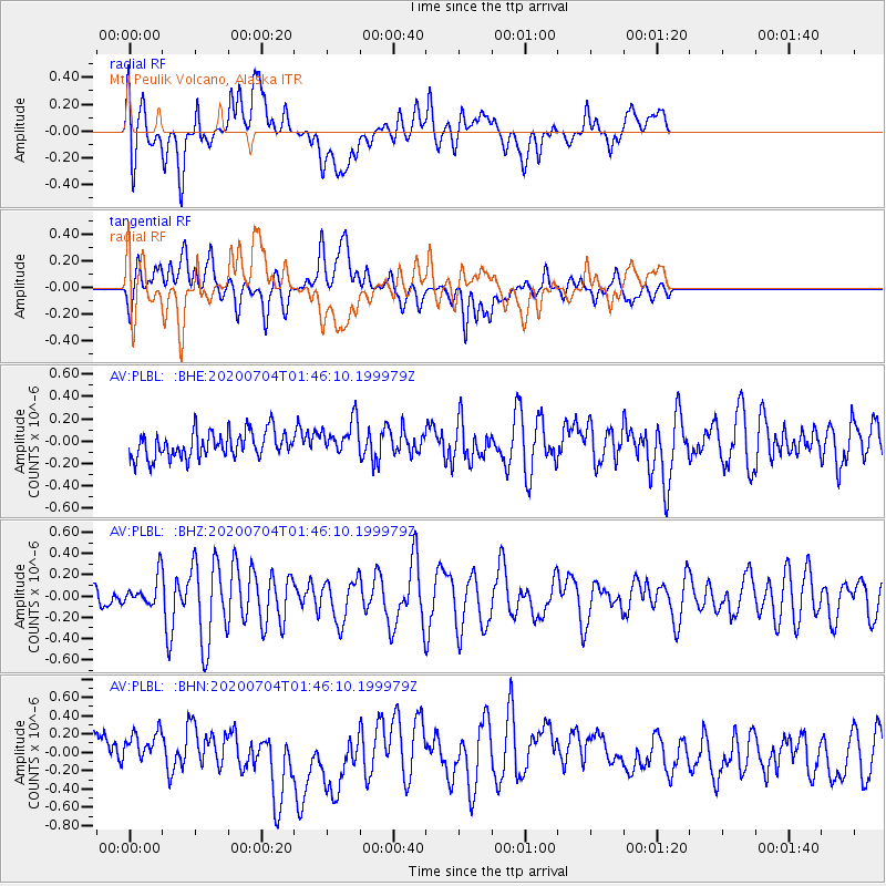
PLBL Mt. Peulik Volcano, Alaska - Earthquake Result Viewer
*The percent match for this event was below the threshold and hence no stack was calculated.
| Earthquake location: |
D'Entrecasteaux Islands Region |
| Earthquake latitude/longitude: |
-9.6/155.0 |
| Earthquake time(UTC): |
2020/07/04 (186) 01:34:44 GMT |
| Earthquake Depth: |
10 km |
| Earthquake Magnitude: |
5.6 Mww |
| Earthquake Catalog/Contributor: |
NEIC PDE/us |
|
| Network: |
AV Alaska Volcano Observatory |
| Station: |
PLBL Mt. Peulik Volcano, Alaska |
| Lat/Lon: |
57.70 N/156.82 W |
| Elevation: |
461 m |
|
| Distance: |
77.7 deg |
| Az: |
24.18 deg |
| Baz: |
228.783 deg |
| Ray Param: |
$rayparam |
*The percent match for this event was below the threshold and hence was not used in the summary stack. |
|
| Radial Match: |
59.68191 % |
| Radial Bump: |
400 |
| Transverse Match: |
50.430573 % |
| Transverse Bump: |
400 |
| SOD ConfigId: |
21709731 |
| Insert Time: |
2020-07-18 01:38:05.431 +0000 |
| GWidth: |
2.5 |
| Max Bumps: |
400 |
| Tol: |
0.001 |
|
Signal To Noise
| Channel | StoN | STA | LTA |
| AV:PLBL: :BHZ:20200704T01:46:10.199979Z | 1.3837548 | 1.3772626E-7 | 9.953083E-8 |
| AV:PLBL: :BHN:20200704T01:46:10.199979Z | 1.2432615 | 1.8251157E-7 | 1.4680063E-7 |
| AV:PLBL: :BHE:20200704T01:46:10.199979Z | 1.309778 | 1.5513432E-7 | 1.1844322E-7 |
| Arrivals |
| Ps | |
| PpPs | |
| PsPs/PpSs | |


