
USP KN.USP - Earthquake Result Viewer
| ||||||||||||||||||
| ||||||||||||||||||
| ||||||||||||||||||
|
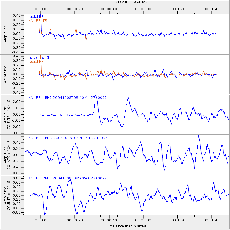
Signal To Noise
| Channel | StoN | STA | LTA |
| KN:USP: :BHN:20041008T08:40:44.274009Z | 1.2513041 | 8.6063565E-8 | 6.8779094E-8 |
| KN:USP: :BHE:20041008T08:40:44.274009Z | 8.931454 | 4.6445285E-7 | 5.200193E-8 |
| KN:USP: :BHZ:20041008T08:40:44.274009Z | 31.833874 | 1.5756741E-6 | 4.9496776E-8 |
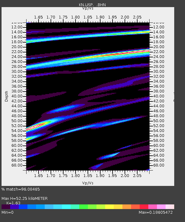
| Arrivals | |
| Ps | 5.3 SECOND |
| PpPs | 21 SECOND |
| PsPs/PpSs | 27 SECOND |

