You are here: Home > Network List > TA - USArray Transportable Network (new EarthScope stations) Stations List
> Station F21K Alatna River, AK, USA > Earthquake Result Viewer
F21K Alatna River, AK, USA - Earthquake Result Viewer
*The percent match for this event was below the threshold and hence no stack was calculated.
| Earthquake location: |
D'Entrecasteaux Islands Region |
| Earthquake latitude/longitude: |
-9.6/155.0 |
| Earthquake time(UTC): |
2020/07/04 (186) 01:34:44 GMT |
| Earthquake Depth: |
10 km |
| Earthquake Magnitude: |
5.6 Mww |
| Earthquake Catalog/Contributor: |
NEIC PDE/us |
|
| Network: |
TA USArray Transportable Network (new EarthScope stations) |
| Station: |
F21K Alatna River, AK, USA |
| Lat/Lon: |
67.22 N/153.48 W |
| Elevation: |
597 m |
|
| Distance: |
85.1 deg |
| Az: |
17.818 deg |
| Baz: |
230.796 deg |
| Ray Param: |
$rayparam |
*The percent match for this event was below the threshold and hence was not used in the summary stack. |
|
| Radial Match: |
59.913425 % |
| Radial Bump: |
400 |
| Transverse Match: |
68.717804 % |
| Transverse Bump: |
400 |
| SOD ConfigId: |
21709731 |
| Insert Time: |
2020-07-18 01:46:50.806 +0000 |
| GWidth: |
2.5 |
| Max Bumps: |
400 |
| Tol: |
0.001 |
|
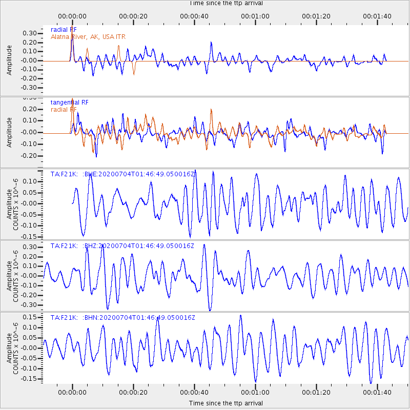
Signal To Noise
| Channel | StoN | STA | LTA |
| TA:F21K: :BHZ:20200704T01:46:49.050016Z | 1.8314782 | 1.1354444E-7 | 6.199606E-8 |
| TA:F21K: :BHN:20200704T01:46:49.050016Z | 1.3135129 | 4.577038E-8 | 3.484578E-8 |
| TA:F21K: :BHE:20200704T01:46:49.050016Z | 0.4547957 | 2.60229E-8 | 5.7218877E-8 |
| Arrivals |
| Ps | |
| PpPs | |
| PsPs/PpSs | |


