USP KN.USP - Earthquake Result Viewer
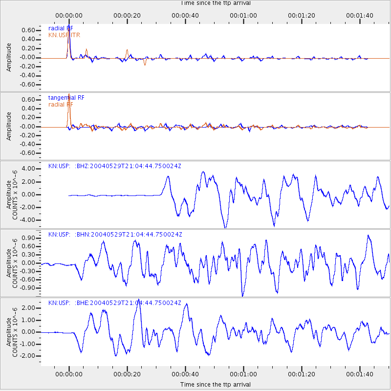
Earthquake location: Off East Coast Of Honshu, Japan
Earthquake latitude/longitude: 34.3/141.4
Earthquake time(UTC): 2004/05/29 (150) 20:56:09 GMT
Earthquake Depth: 16 km
Earthquake Magnitude: 5.6 MB, 6.6 MS, 6.5 MW, 6.3 MW
Earthquake Catalog/Contributor: WHDF/NEIC
Network: KN Kyrgyz Seismic Telemetry Network
Station: USP KN.USP
Lat/Lon: 43.27 N/74.50 E
Elevation: 740 m
Distance: 51.7 deg
Az: 301.092 deg
Baz: 76.187 deg
Ray Param: 0.067235135
Estimated Moho Depth: 39.0 km
Estimated Crust Vp/Vs: 1.65
Assumed Crust Vp: 6.306 km/s
Estimated Crust Vs: 3.816 km/s
Estimated Crust Poisson's Ratio: 0.21
Radial Match: 96.61072 %
Radial Bump: 310
Transverse Match: 86.07158 %
Transverse Bump: 400
SOD ConfigId: 2459
Insert Time: 2010-03-08 22:27:22.358 +0000
GWidth: 2.5
Max Bumps: 400
Tol: 0.001

Signal To Noise

ChannelStoNSTALTA
KN:USP: :BHN:20040529T21:04:44.750024Z6.038822.797536E-74.6325876E-8
KN:USP: :BHE:20040529T21:04:44.750024Z37.3234337.585262E-72.0323055E-8
KN:USP: :BHZ:20040529T21:04:44.750024Z30.3180161.4400833E-64.749926E-8
Arrivals
Ps4.3 SECOND
PpPs15 SECOND
PsPs/PpSs20 SECOND