
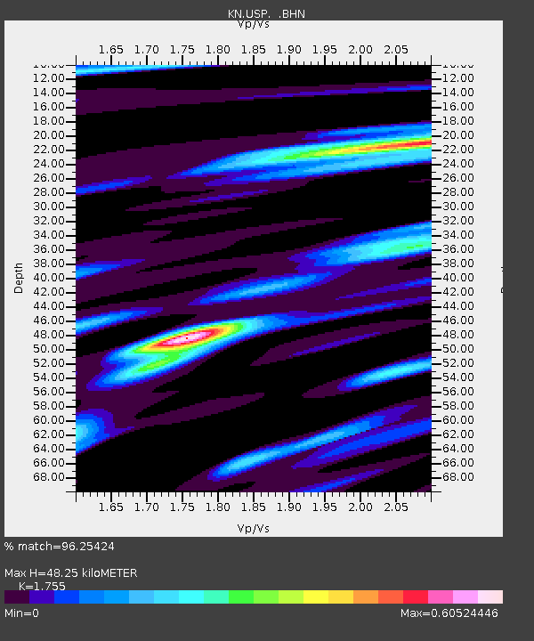
USP KN.USP - Earthquake Result Viewer
| ||||||||||||||||||
| ||||||||||||||||||
| ||||||||||||||||||
|
Signal To Noise
| Channel | StoN | STA | LTA |
| KN:USP: :BHN:20040205T21:15:53.899021Z | 3.514055 | 1.4628624E-7 | 4.1628898E-8 |
| KN:USP: :BHE:20040205T21:15:53.899021Z | 3.9818556 | 3.3923183E-7 | 8.519441E-8 |
| KN:USP: :BHZ:20040205T21:15:53.899021Z | 9.216117 | 8.412412E-7 | 9.1279354E-8 |
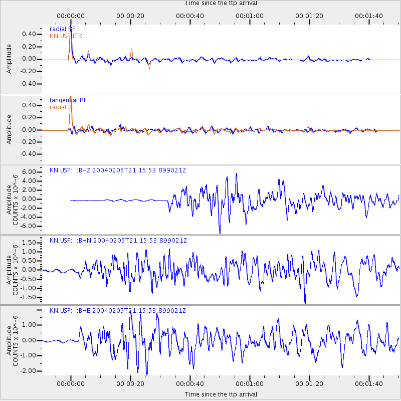
| Arrivals | |
| Ps | 6.0 SECOND |
| PpPs | 20 SECOND |
| PsPs/PpSs | 26 SECOND |

