USP KN.USP - Earthquake Result Viewer
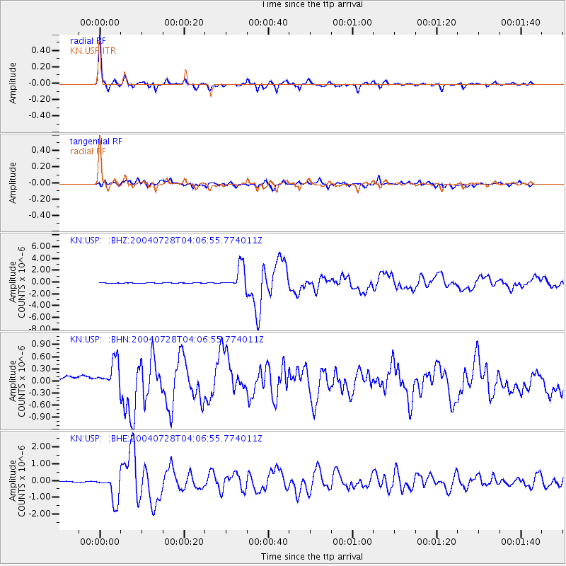
Earthquake location: Irian Jaya Region, Indonesia
Earthquake latitude/longitude: -0.4/133.1
Earthquake time(UTC): 2004/07/28 (210) 03:56:28 GMT
Earthquake Depth: 13 km
Earthquake Magnitude: 6.0 MB, 6.3 MS, 6.5 MW, 6.4 MW
Earthquake Catalog/Contributor: WHDF/NEIC
Network: KN Kyrgyz Seismic Telemetry Network
Station: USP KN.USP
Lat/Lon: 43.27 N/74.50 E
Elevation: 740 m
Distance: 67.9 deg
Az: 317.73 deg
Baz: 112.957 deg
Ray Param: 0.056615755
Estimated Moho Depth: 47.75 km
Estimated Crust Vp/Vs: 1.77
Assumed Crust Vp: 6.306 km/s
Estimated Crust Vs: 3.558 km/s
Estimated Crust Poisson's Ratio: 0.27
Radial Match: 97.504654 %
Radial Bump: 324
Transverse Match: 86.014114 %
Transverse Bump: 400
SOD ConfigId: 2459
Insert Time: 2010-03-08 22:28:08.829 +0000
GWidth: 2.5
Max Bumps: 400
Tol: 0.001

Signal To Noise

ChannelStoNSTALTA
KN:USP: :BHN:20040728T04:06:55.774011Z4.87726163.6205574E-77.4233405E-8
KN:USP: :BHE:20040728T04:06:55.774011Z40.087328.455566E-72.109287E-8
KN:USP: :BHZ:20040728T04:06:55.774011Z52.9150242.0401042E-63.8554347E-8
Arrivals
Ps6.1 SECOND
PpPs20 SECOND
PsPs/PpSs26 SECOND