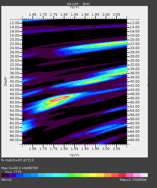
USP KN.USP - Earthquake Result Viewer
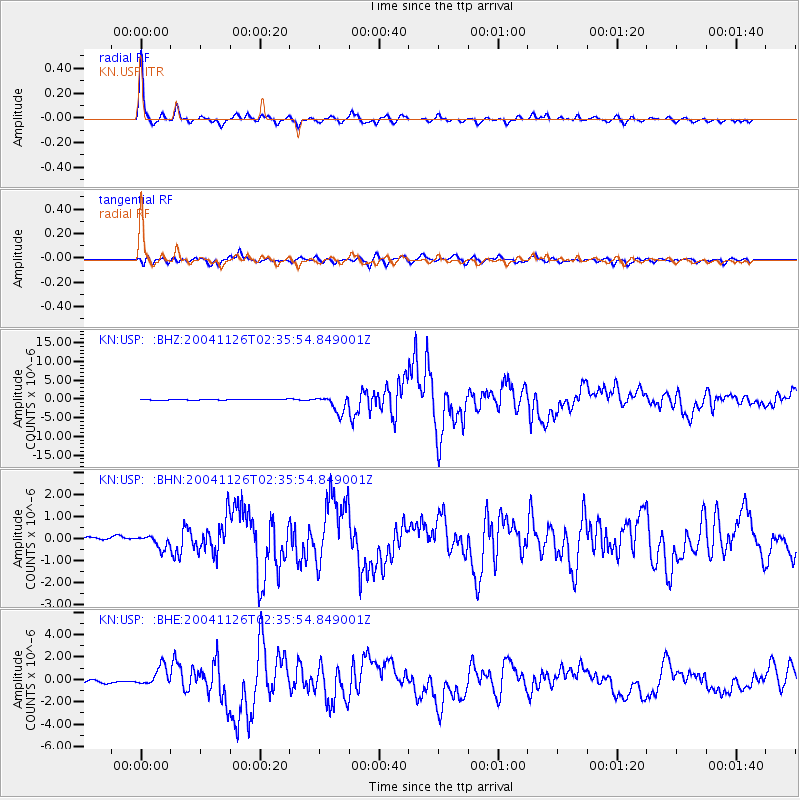
Earthquake location: Irian Jaya Region, Indonesia
Earthquake latitude/longitude: -3.6/135.4
Earthquake time(UTC): 2004/11/26 (331) 02:25:03 GMT
Earthquake Depth: 10 km
Earthquake Magnitude: 6.2 MB, 7.2 MS, 7.1 MW, 7.0 MW
Earthquake Catalog/Contributor: WHDF/NEIC
Network: KN Kyrgyz Seismic Telemetry Network
Station: USP KN.USP
Lat/Lon: 43.27 N/74.50 E
Elevation: 740 m
Distance: 71.8 deg
Az: 317.796 deg
Baz: 113.385 deg
Ray Param: 0.05406489
Estimated Moho Depth: 48.0 km
Estimated Crust Vp/Vs: 1.78
Assumed Crust Vp: 6.306 km/s
Estimated Crust Vs: 3.548 km/s
Estimated Crust Poisson's Ratio: 0.27
Radial Match: 97.67213 %
Radial Bump: 305
Transverse Match: 88.39604 %
Transverse Bump: 400
SOD ConfigId: 2459
Insert Time: 2010-03-08 22:28:11.030 +0000
GWidth: 2.5
Max Bumps: 400
Tol: 0.001

Signal To Noise

ChannelStoNSTALTA
KN:USP: :BHN:20041126T02:35:54.849001Z1.2476692.6816699E-72.149344E-7
KN:USP: :BHE:20041126T02:35:54.849001Z6.50437558.618037E-71.3249598E-7
KN:USP: :BHZ:20041126T02:35:54.849001Z22.721932.292195E-61.008803E-7
Arrivals
Ps6.1 SECOND
PpPs20 SECOND
PsPs/PpSs27 SECOND