You are here: Home > Network List > KN - Kyrgyz Seismic Telemetry Network Stations List
> Station USP KN.USP > Earthquake Result Viewer
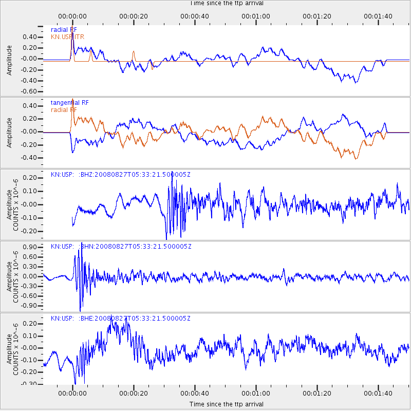
USP KN.USP - Earthquake Result Viewer
*The percent match for this event was below the threshold and hence no stack was calculated.
| Earthquake location: |
Kuril Islands |
| Earthquake latitude/longitude: |
46.7/152.5 |
| Earthquake time(UTC): |
2008/08/27 (240) 05:24:41 GMT |
| Earthquake Depth: |
65 km |
| Earthquake Magnitude: |
5.5 MB, 5.4 MW, 5.3 MW |
| Earthquake Catalog/Contributor: |
WHDF/NEIC |
|
| Network: |
KN Kyrgyz Seismic Telemetry Network |
| Station: |
USP KN.USP |
| Lat/Lon: |
43.27 N/74.50 E |
| Elevation: |
740 m |
|
| Distance: |
53.1 deg |
| Az: |
296.708 deg |
| Baz: |
57.278 deg |
| Ray Param: |
$rayparam |
*The percent match for this event was below the threshold and hence was not used in the summary stack. |
|
| Radial Match: |
43.20765 % |
| Radial Bump: |
400 |
| Transverse Match: |
21.34872 % |
| Transverse Bump: |
400 |
| SOD ConfigId: |
2504 |
| Insert Time: |
2010-03-08 22:29:11.441 +0000 |
| GWidth: |
2.5 |
| Max Bumps: |
400 |
| Tol: |
0.001 |
|
Signal To Noise
| Channel | StoN | STA | LTA |
| KN:USP: :BHN:20080827T05:33:21.500005Z | 9.294026 | 4.6606075E-7 | 5.014627E-8 |
| KN:USP: :BHE:20080827T05:33:21.500005Z | 1.1887808 | 2.4233074E-7 | 2.0384812E-7 |
| KN:USP: :BHZ:20080827T05:33:21.500005Z | 2.3644972 | 1.2440186E-7 | 5.2612396E-8 |
| Arrivals |
| Ps | |
| PpPs | |
| PsPs/PpSs | |


